10 Best Hikes in Sedona AZ to do For First Time Visitors

If you’re looking for the best hikes in Sedona AZ and are a first time visitor to the area, this post is going to show you 10 trails which you honestly can’t go wrong with. They are stunning, highly rated, some even have vortexes and are going to be a great introduction for your visit here.
The List:
- Soldiers Pass trail
- Fay Canyon trail
- Robbers Roost trail (Vortex)
- West Fork trail
- Cathedral Rock trail (Vortex)
- Birthing Cave trail (Vortex)
- Keyhole Cave trail (Vortex)
- Boyton Canyon Subway Cave trail (Vortex)
- Vultee Arch trail
- Devils Bridge trail
Tips:
- Red Rock Pass: These are $5 parking passes that are required on most hikes in Sedona AZ. They are available at most trailheads and can also be bought online.
- Be respectful of the areas: Many hikes in Sedona are on preserved land and you should absolutely be respectful of the area, not litter, take out your trash and not damage any sacred areas.
- Start hikes super early: The hikes in Sedona AZ are some of the most popular in the world and as such as often super crowded. Starting early gives you a better chance to find parking and do the trail without being bothered.
- Some of these trails have vortexes: These are considered energy centers and there are some trails that I’ve done in this list in which I felt something was happening. Even my phone GPS went crazy once.
- Hike details included: Some of these hikes require more context than just a trailhead location and I’ve included step by step guides for each one.
Gear recommendations:
- Best rated hiking shoes for day hikes (men/women sizes available)
- Best rated hiking backpack for day hikes
- Best rated hiking pole for day hikes
Soldiers Pass trail:
- Distance: 4-5 miles
- Location: Soldiers Pass trailhead
- Difficulty: Moderate
- Elevation: 500 feet
- Vortexes? No
- Red Rock Pass required? No
This is one of my favorite hiking trails in Sedona. You’ll be walking on a relatively easy trail with slight inclines and declines for 2 miles before venturing off into a more remote hike that takes you to the famous Soldiers Pass Caves. That is where the elevation of the hike increases a few 100 feet, but the caves are the best part of the hike in my opinion.
Personal tips: The trailhead is open from 8am-6pm, and because the parking lot can only fit 10 cars get there early or be ready to wait a bit. There is no nearby parking lot so if you can get there early do it, or have someone drive you to the trailhead (there is a decent phone signal there).
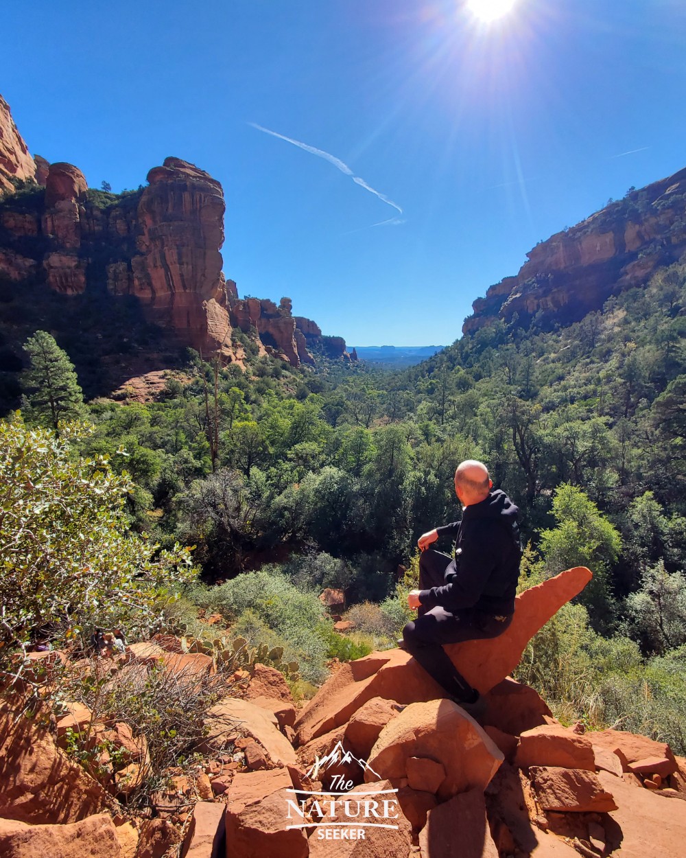
Fay Canyon trail:
- Distance: 2.5 miles
- Location: Fay Canyon trailhead
- Difficulty: Beginner
- Elevation: 50-100 feet
- Vortexes? No
- Red Rock Pass required? Yes
This trail was one of the biggest surprises for me because of it’s beauty, lack of crowds and little easter eggs that I found. This hike is short, extremely scenic and takes you inside the Fay Canyon area. There is a mostly flat hike involved where you’ll go through a forest but it ends with a short scramble to the beautiful overlook you see above.
Personal tips: This hike is short, awesome and has a bonus arch you can check out known as the Fay Canyon Arch. It’s accessible as you get about 0.3 miles into the trail from the parking lot and the details of that and how to navigate this area are all covered in my Fay Canyon trail post.
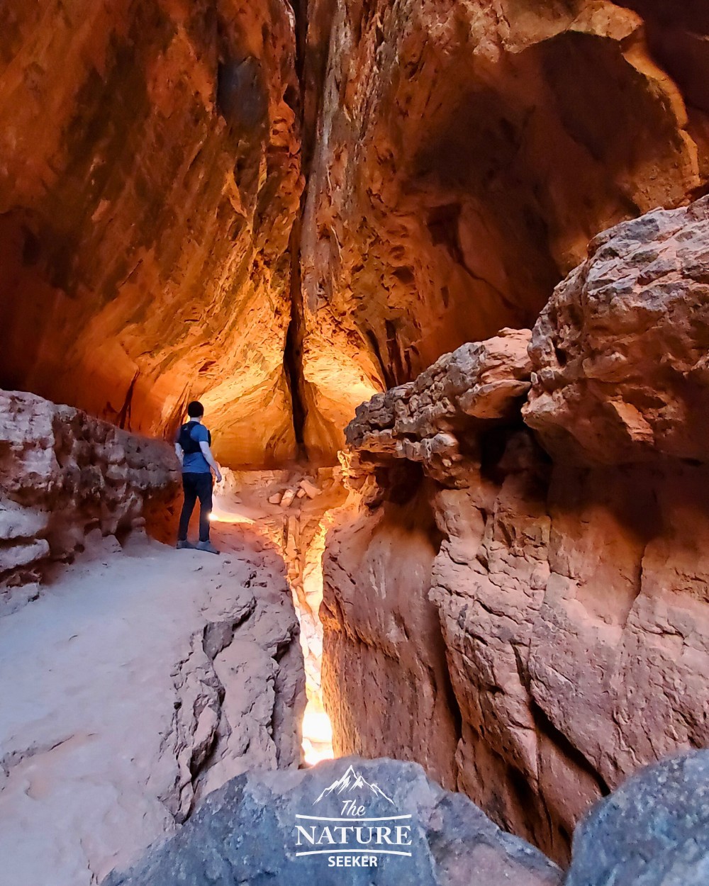
Robbers Roost trail (Hide Out Cave):
- Distance: 1.5 miles
- Location: Robbers Roost trailhead
- Difficulty: Moderate
- Elevation: 50-100 feet
- Vortexes? Yes
- Red Rock Pass required? No
Exploring Robbers Roost is like a 90% drive, and 10% hiking experience. The trail to it is somewhat outside the Sedona area and requires you drive through pretty remote areas, but this hike is still a popular one so there’s a GOOD chance you will see other cars on the trailhead no matter when you go. The actual Robbers Roost trail is very short and the Hide Out Cave is small, but offers great scenery.
Personal tips: Don’t drive on the remote roads fast, take your time. Once you reach the parking lot, you will have to hike about 1 more mile to get to the actual Robbers Roost. 3/4 of that mile hike can be done in a 4×4 or dune buggy if you have it, but if not, don’t risk it, park your car in the parking lot and just hike the rest of the road to Robbers Roost. If you can get here during sunrise or sunset, and on a weekday when there are less people, you are likely to get the best experience on this hike. There will be a short and somewhat dangerous scramble to reach Hide Out Cave but most people can complete it easily.
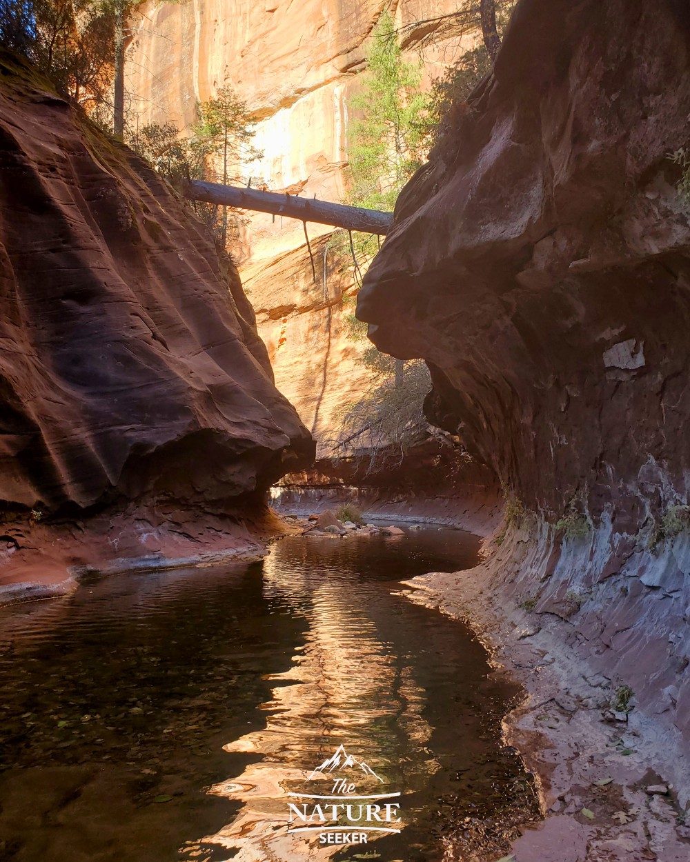
West Fork Trail:
- Distance: Up to 14 miles
- Location: West Fork trailhead
- Difficulty: Moderate
- Elevation: 200 feet
- Vortexes? No
- Red Rock Pass required? No (but there is an $8 fee to enter)
This trail involves you going through about 4 miles by the West Fork river and underneath beautiful canyon walls. At about 4 miles, you’ll come across a “warning” sign saying that to progress further, you need to get into knee deep water. From that area, it’s about another 2 mile hike, then back to the parking lot.
Recommendations: Absolutely do the extra 2-3 miles of the West Fork Trail hike that involves getting in the water. That is where it gets amazingly good both in terms of scenery, the experience and the fact that there’s less people in that section of the trail.
If the water is super cold, I recommend checking out the best waterproof socks I compiled a list of. I used one of these on my hike there (in the winter by the way) and it was an incredible experience.
Cathedral Rock trail:
- Distance: 2 miles
- Location: Cathedral Rock trailhead
- Difficulty: Hard
- Elevation: 900 feet
- Vortexes? Yes
- Red Rock Pass required? Yes
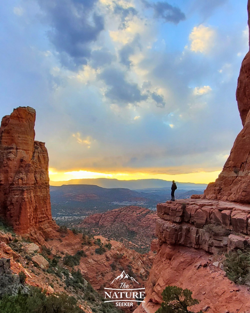
The Cathedral Rock trail is an amazing, short but difficult hike to the top of a mountain with several gems to admire: An amazing overlook, stone pillars and more. The hardest part of this hike is the incline you have to do. It’s short, but because of the elevation, that makes it difficult (it’s over 900 feet).
Personal tips: Go when it’s cold (early morning, autumn and winter) because you will sweat while going up on this trail. The parking lot for this hike is also very small so be aware of that.
Also wear somewhat decent hiking shoes or above. I wore the Salomon Speedcross 5 shoes on this and they did very well (you may have slippery areas otherwise). At the top, there may be a line to get the picture of the iconic overlook, but behind it (further up), there is an equally good overlook (with 3 stone pillars called the Sisters) that overlooks Sedona from a different angle worth seeing (and less crowds).
Birthing Cave:
- Distance: 2 miles
- Location: Long Canyon trailhead
- Difficulty: Moderate
- Elevation: 300 feet
- Vortexes? Yes
- Red Rock Pass required? No
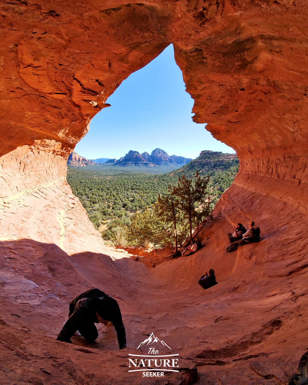
Details: The hike to Birthing Cave is pretty scenic at the start, boring in the middle and amazing at the end when you reach the cave. That cave looks incredible from the inside, but I would caution anyone who wishes to climb deeper/higher in it as it gets a little uneven on the rocks and sometimes slippery as well. This hike is also one of the few on this list which doesn’t have an official trailhead (Long Canyon Trailhead is where it actually begins).
Recommendations: Generally speaking, go here when it’s cooler because you will be hiking in open Sedona desert for most of the trail. Also I recommend looking at the directions I made on my Birthing Cave trail post which shows you exactly how to get there.
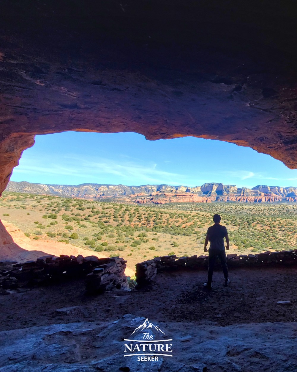
Keyhole Cave:
- Distance: 2 miles
- Location: Sugarloaf trailhead
- Difficulty: Hard
- Elevation: 500 feet
- Vortexes? Yes
- Red Rock Pass required? Yes
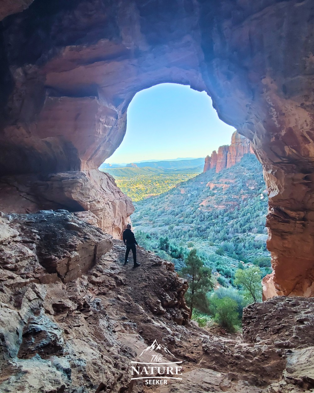
This is another unofficial trail that I consider to be one of the best hikes in Sedona AZ. You will park at Sugarloaf trailhead and then have to navigate (visually) to the cave which you will be able to see from the parking area. The hike to the cave is very bushy and you may have to go through a bunch of cactuses, but once you reach the cave, it’s an amazing experience. You can also elect to climb a bit in this cave once you reach it but I would caution against it since it can be dangerous, but the views of Sedona from there are awesome!
Recommendations: Use Alltrails which has a map of this area. You can also use my Keyhole Cave trail post to navigate to it and back to the parking lot. Wear fully clothed gear, especially pants because you will likely have to walk through tons of cactus.
Boyton Canyon Subway trail:
- Distance: 5 miles
- Location: Boyton Canyon trailhead
- Difficulty: Moderate
- Elevation: 500 feet
- Vortexes? Yes
- Red Rock Pass required? Yes
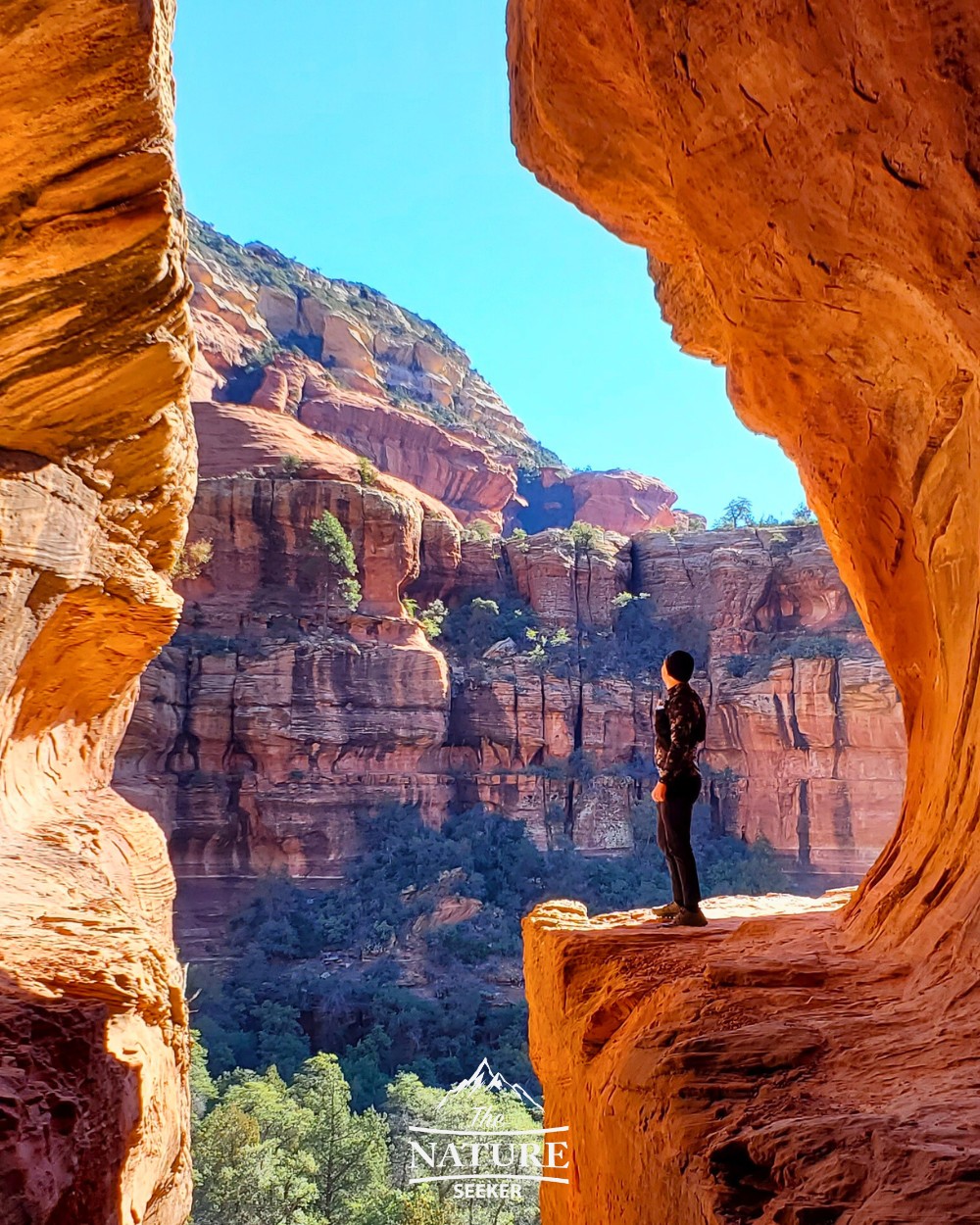
Early morning hikes there are what I’d recommend. One other possibility (if the parking lot is full) is to park at the Fay Canyon trailhead which is only about a 10 minute walk from there and then walk to this trailhead, then start it. Most of the hike to the Boyton Subway Cave is OK, but to reach the actual Sedona Subway Cave, you need to veer off trail at a certain point 2 miles in and then somewhat bushwhack through the woods for another 1 mile or so before reaching the cave.
The actual Subway part of the hike is awesome, but a little scary for some as there is a somewhat elevated scramble to reach it. You can actually go around it to see even more amazing Sedona views.
Personal tips: You will likely see a lot of other people walking on this trail so you shouldn’t have problems finding the Subway Cave or getting lost in the woods, but just in case, get a map (from Alltrails) or read my instructions above how to find it. If you do find yourself wondering where it is and don’t have a map, wait for other hikers to pass by and ask them, or if they are going there and know the way, go with them if they’ll agree.
Vultee Arch trail:
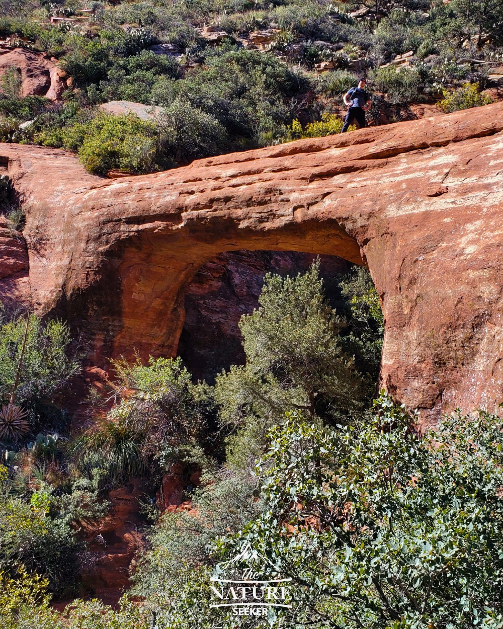
- Distance: 4-8 miles
- Location: Sterling Pass trailhead
- Difficulty: Hard
- Elevation: 2,000 feet
- Vortexes? No
- Red Rock Pass required? No
The Vultee Arch trail is an incredible hike that is often not nearly as crowded as most others on this list and there’s actually 2 trails that take you there (an easy and difficult one). I’m recommending the difficult one because the easy version requires a long drive on a super rugged road which if you don’t have a 4×4 car for, forget it. The harder version of the hike however is very scenic, difficult but worthwhile.
Devils Bridge:
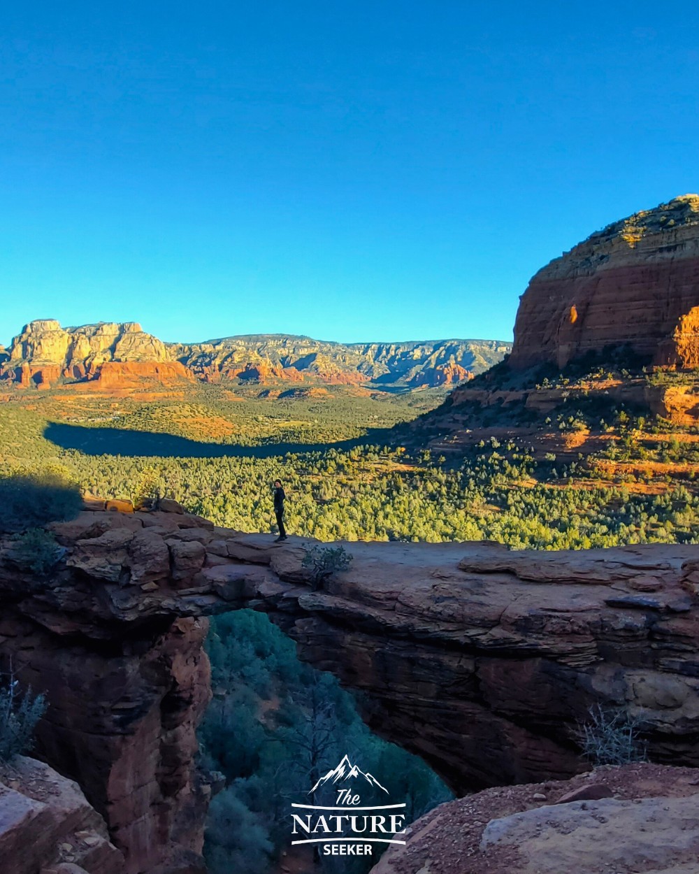
- Distance: 6 miles
- Location: Dry Creek trailhead
- Difficulty: Moderate
- Elevation: 500 feet
- Vortexes? No
- Red Rock Pass required? Yes
Devils Bridge Sedona is likely one of the top marketed hikes in Sedona AZ and I’m including it on this list because it is worth doing. There are actually 4 different ways to hike there but I included the most popular one which is starting at Dry Creek Trailhead. The hike itself is half through a dirt road, and half upward to the actual Devils Bridge. Once you’re there, you can get an amazing photograph of it and even hike to the bottom of it if you’re not satisfied.
Recommendations: Absolutely go here super early. Even if you arrive at 7 a.m, you’ll likely already see crowds. I think the only people who avoid any crowds on this hike are those who literally get there around sunrise. If you don’t mind crowds, you may want to rethink that because there is a very long line once you get close to Devils Bridge to wait on, so if you can get here and avoid that, do it!
Sedona Hiking Gear Recommendations:
- Best rated hiking shoes for day hikes (men/women sizes available)
- Best rated hiking backpack for day hikes
- Best rated hiking pole for day hikes