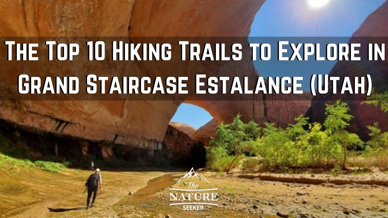
16 Best Hikes in Grand Staircase Escalante National Monument
I am proud to say that I have explored many hikes in Grand Staircase Escalante and the 16 specific ones I want to show you here might honestly be the best ones you’ll find not only in the area, but in all of Utah overall.
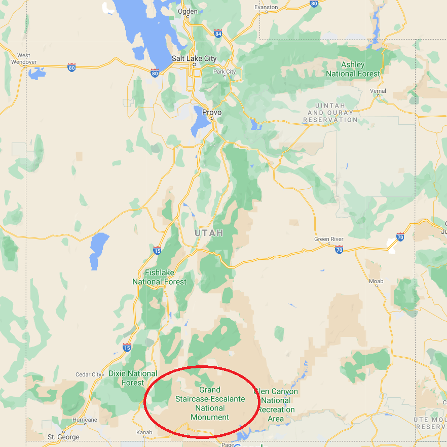
Grand Staircase Escalante National Monument is basically a 1 million+ acre stretch of land in Utah that is uninhabited but has many areas you can explore within it (hikes, official trails, off road drives, camping, scenic overlooks, etc…). The land in this area takes up about 5-10% of the entire state and that “small area” holds many opportunities for adventures.
There are several towns around Grand Staircase Escalante you can stay at to explore this area including the towns of Escalante itself, Kanab and even Page AZ (that town is actually very close to the south eastern side of the region even though it’s officially in Arizona).
I would recommend planning 3 different road trips to stay in each town so you can complete a large portion of the hikes you’ll find in the list below. 90% of the hikes I am listing below can be accessed from one of these 3 towns and just as well, future hikes I’ll be adding to the list can also be accessed from the same places.

My history exploring Grand Staircase-Escalante National Monument:
When I first started exploring Utah, I figured the best hikes and places to see there were The Mighty 5 National Parks there. But I was very wrong, because as soon I discovered one of the hikes on this list (Coyote Gulch) and that it was part of the Grand Staircase Escalante National Monument area, I quickly discovered that how large this whole region was and just how many more incredible hikes, trails and sights it held. And so I would revisit the Grand Staircase Escalante area over and over throughout the years, and add one or more hikes each time to my list of explorations and I intend to keep that flow going because this part of Utah is highly underrated and also not even close to as crowded as the national parks there.What is Grand Staircase Escalante National Monument?
Here are the 16 best Grand Staircase Escalante hikes:
- Golden Cathedral trail hike.
- Coyote Gulch hike.
- Red breaks and Cosmic Ashtray hike.
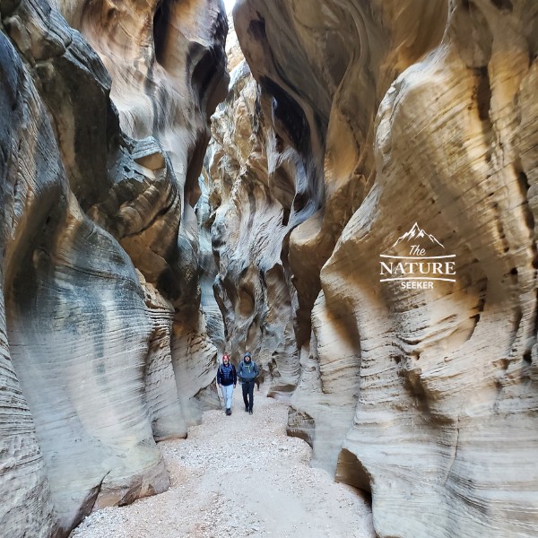
- Zebra Slot Canyon hike.
- Peekaboo and Spooky Gulch hike.
- Lower Calf Creek Falls (100 foot waterfall).
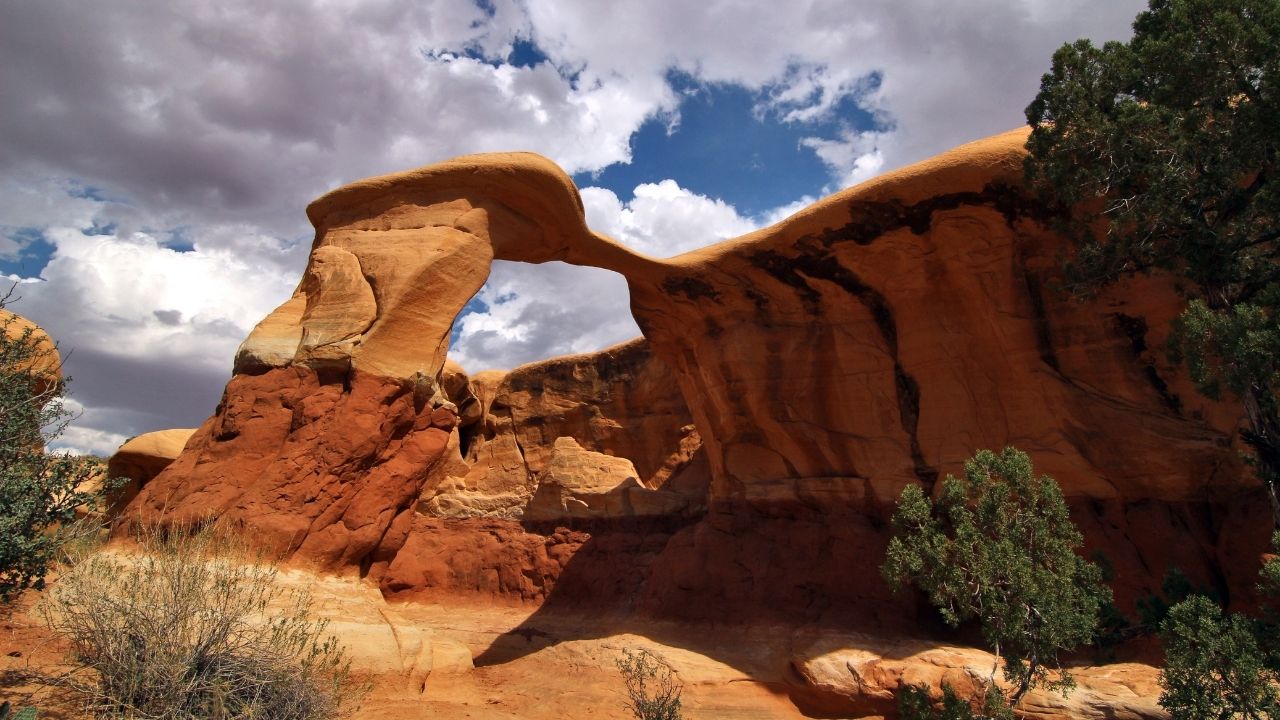
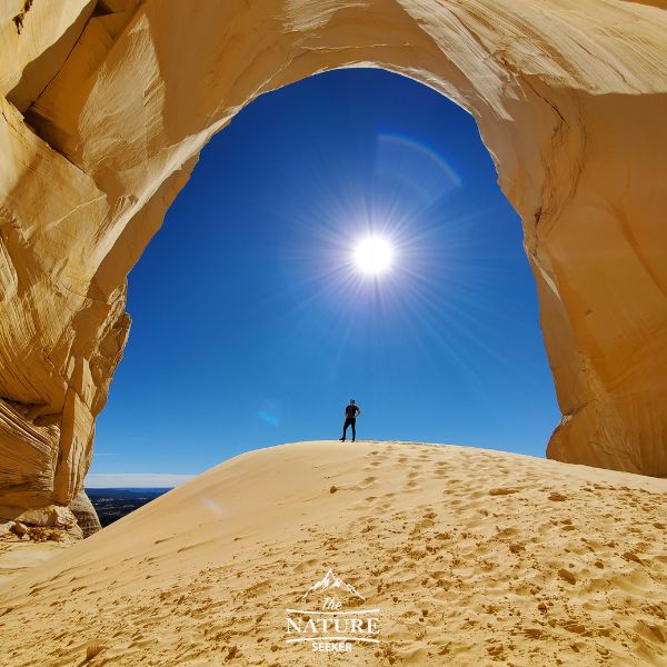
- Sunset Arch.
- Metate Arch (Devils Garden).
- Long Canyon and Singing Canyon.
- Escalante Natural Bridge trail.
- Head of the Rocks Overlook.
- Wire Pass trail (slot canyon).
- Willis Creek Slot Canyon.
- Great Chamber at Cutler Point.
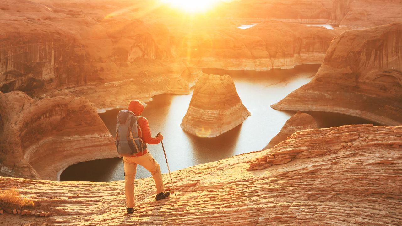
- Reflection Canyon.
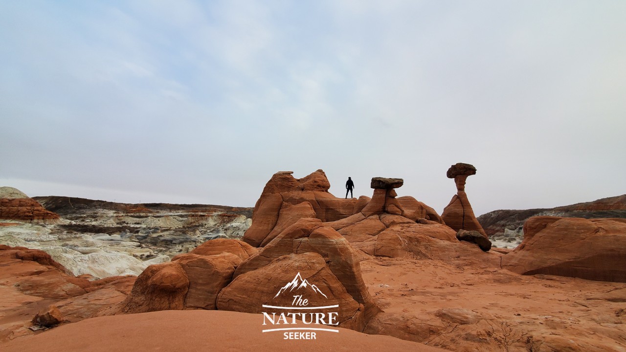
- Toadstool Hoodoos.
2 important things to know before doing these Grand Staircase-Escalante hikes:
- Grand Staircase Escalante is gigantic and has many access points and many of the hikes on this list can be accessed from different parts of it. I’ll be detailing how and where to find each one.
- Grand Staircase Escalante has a ton of remote areas and most of the hikes on this list are not just deep in this national monument but may also require you drive on dirt, gravel or very rocky roads in some cases.
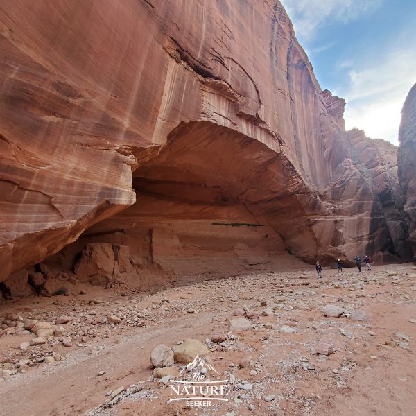
Golden Cathedral hike:
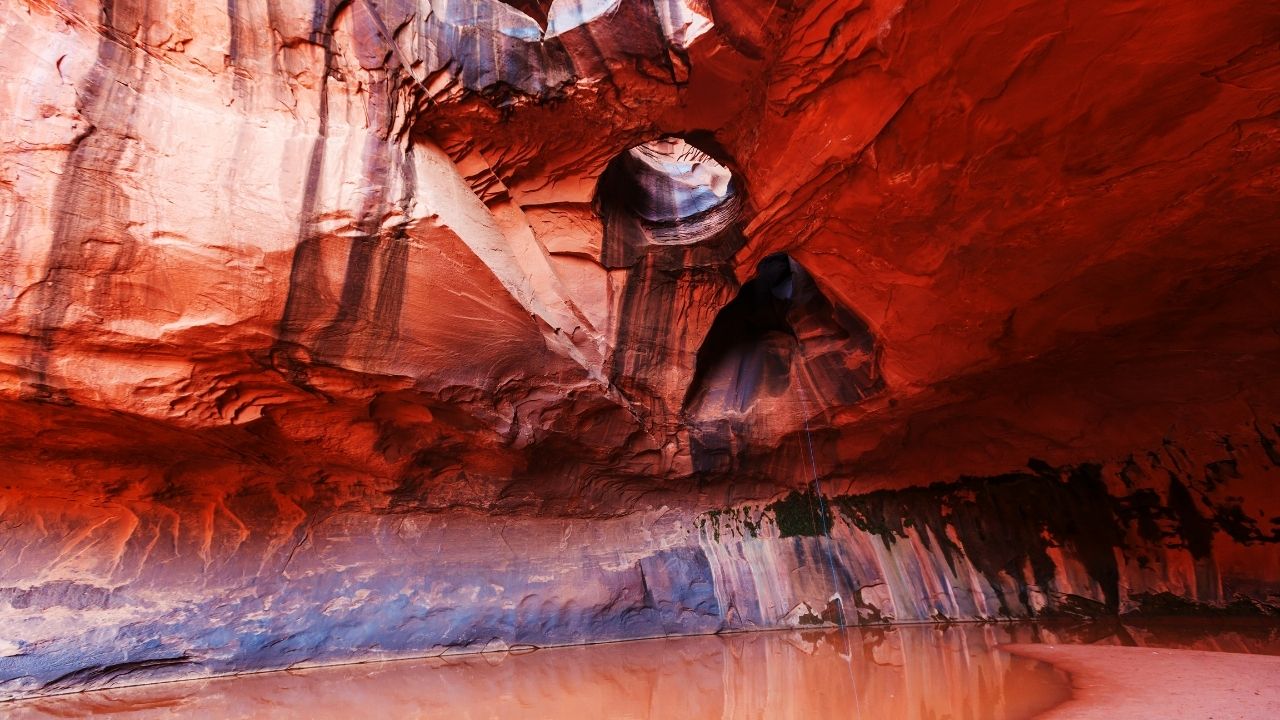
- Length of hike: A little over 6 miles (it’s an in and out trail)
- Starting point: Golden Cathedral Trailhead
- All wheel drive or 4×4 required to get to the hike? Not really
- Hike difficulty: Moderate
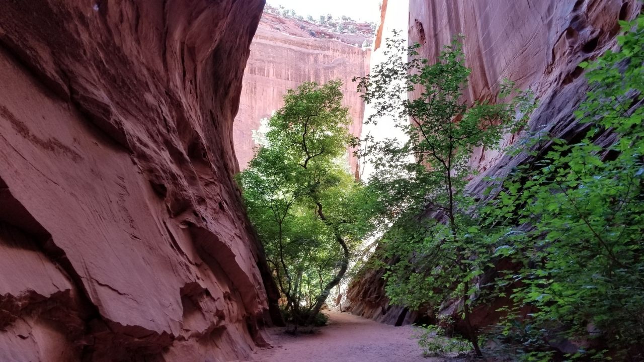
Coyote Gulch hiking trail:
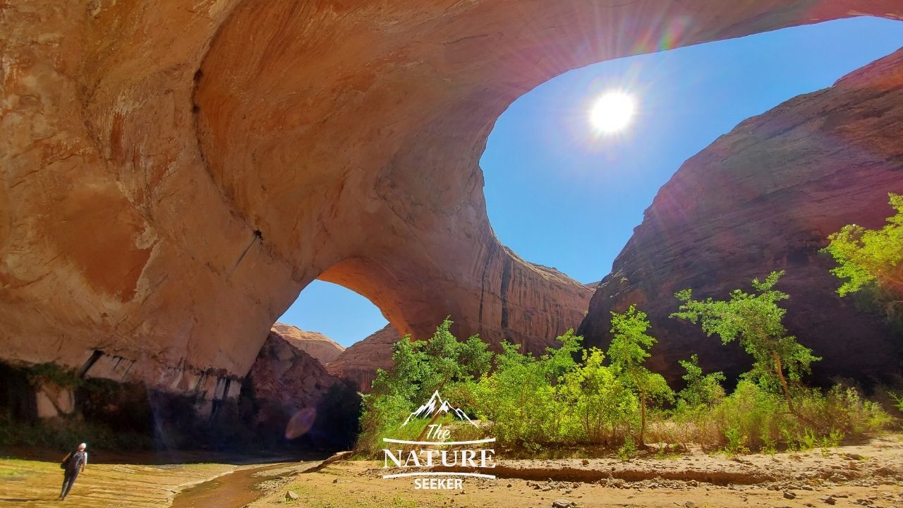
- Length of hike: 5-20 miles depending on which route you take. There are 4 different options available.
- Starting point: Water tanks trailhead
- All wheel drive or 4×4 required to get to the hike? Yes!
- Hike difficulty: Moderate
- Jacob Hamlin Arch (the photo above).
- Coyote Nature Bridge.
- “Secret” Lagoon (easy to find with research).
- Steven’s Arch.
- This is all within a 10 mile hike within Coyote Gulch.
- Also there is an area in Arizona called Canyon de Chelly which has similar sights as you see in Coyote Gulch (if you enjoy it here and want to see similar places, there’s at least 1 more option).
Red Breaks and Cosmic Ashtray hike:
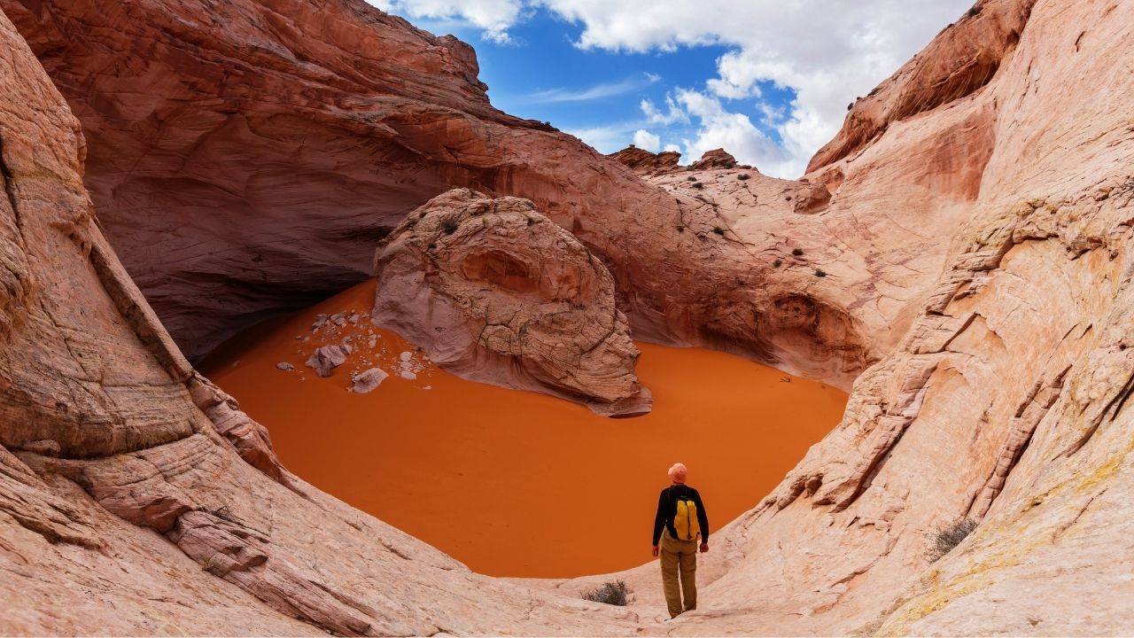
- Length of hike: 8-9 miles in and out
- Starting location: Alltrail map
- All wheel drive or 4×4 required to get to the trail? Yes!
- Hike difficulty: Hard
Zebra Slot Canyon:
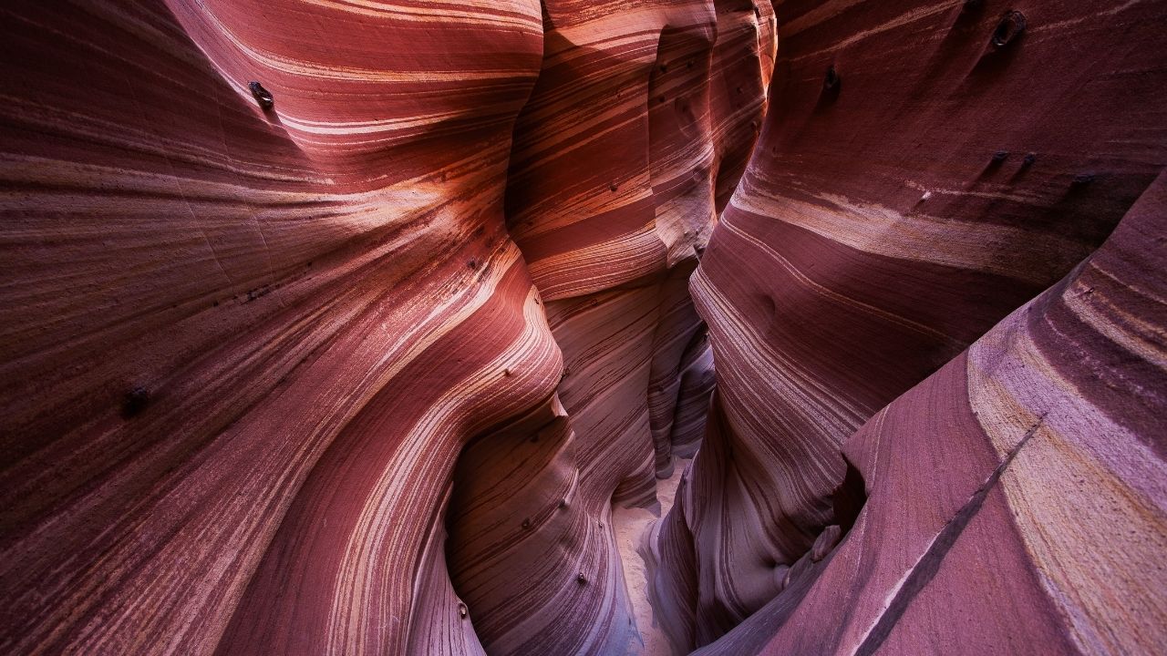
- Length of hike: 5+ miles.
- Starting point: Zebra trailhead
- All wheel drive or 4×4 required to get to the trail? Yes.
- Hike difficulty: Moderate
Peekaboo Slot Canyon and Spooky Gulch hike:
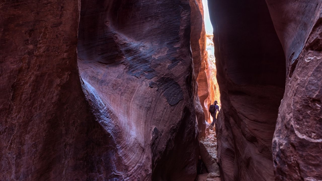
- Length of hike: About 5 miles for both slot canyons
- Starting point: Upper Dry Fork trailhead
- All wheel drive or 4×4 required to get to the trail? Yes
- Hike difficulty: Hard
Lower Calf Creek falls:
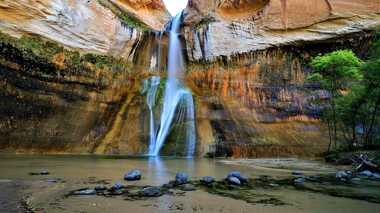
- Length of hike: 5-6 miles in and out
- Starting point: Lower Calf Creek Falls trailhead
- All wheel drive or 4×4 required to get to? No!
- Hike difficulty: Moderate
Sunset Arch:
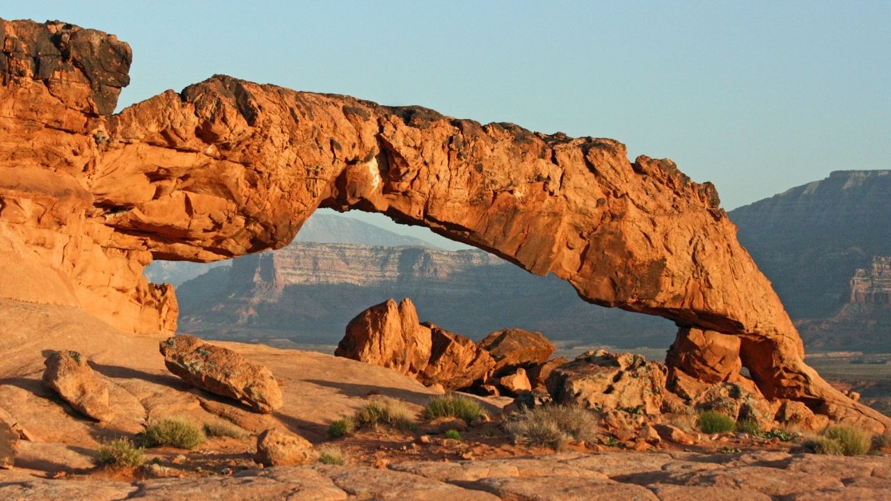
- Length of hike: 1/2 mile
- Starting point: Water Tanks trailhead
- All wheel drive or 4×4 required to get to the hike? Yes!
- Hike difficulty: Easy
Metate Arch (Devils Garden):
- Length of hike: 1/10th of a mile (very close to the parking lot).
- Starting point: Devils Garden parking
- All wheel drive or 4×4 required to get to the hike? Not really
- Hike difficulty: Easy
Long Canyon and Singing Canyon:
- Length of hike: 1/8 mile from the parking lot.
- Starting point: Singing Canyon trailhead
- All wheel drive or 4×4 required to get to the hike? No
- Hike difficulty: Easy
Escalante Natural Bridge trail:
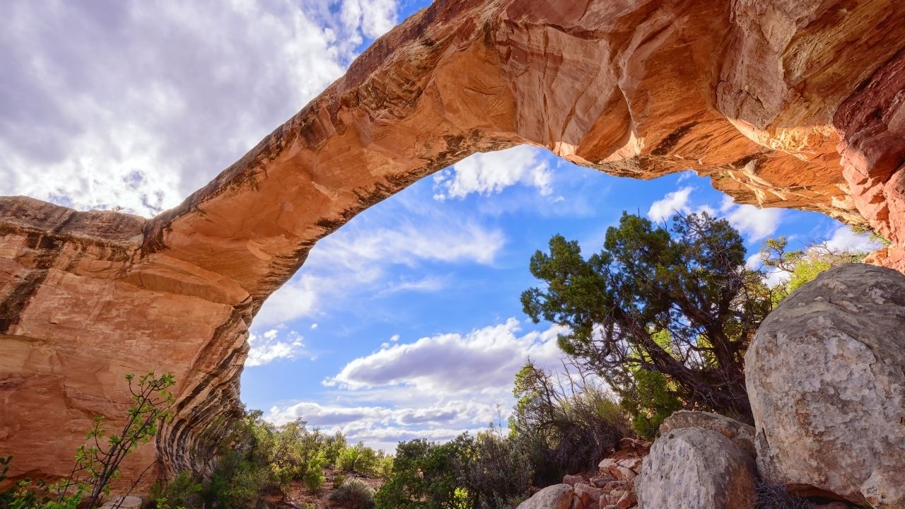
- Length of hike: 4-5 miles in and out.
- Starting point: Escalante River trailhead
- All wheel drive or 4×4 required to get to the trail? No!
- Hike difficulty: Moderate
Head of the Rocks Overlook (and hikes near it):
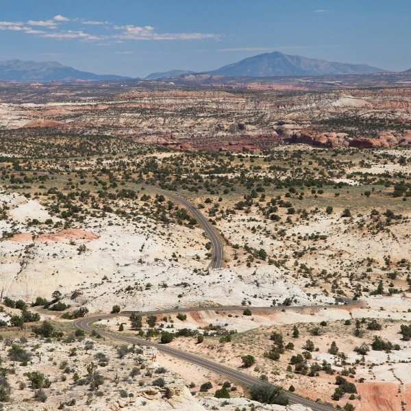
- Length of hike: 0! This area is “just” an overlook (and it’s an amazing one).
- Starting point: Head of The Rocks Overlook
- All wheel drive or 4×4 required to get to the hike? No!
- Hike difficulty: Super easy
Wire Pass trail:
- Length of hike: 3 miles in and out.
- Starting point: Wire Pass trailhead
- All wheel drive or 4×4 required to get to the hike? Somewhat.
- Hike difficulty: Easy
Willis Creek Slot Canyon:
- Length of hike: Up to 6 miles in and out.
- Starting point: Willis Creek Trailhead
- All wheel drive or 4×4 required to get to the trail? Yes.
- Hike difficulty: Easy
Great Chamber in Cutler Point:
- Length of hike: 15+ miles if you do it the normal way (other options exist and I’ll add directions in a separate post on that).
- Starting point: Alltrails map
- All wheel drive or 4×4 required to get to the trail? Yes!
- Hike difficulty: Hard
Reflection Canyon:
- Length of hike: 15+ miles in and out.
- Starting point: Reflection Canyon trailhead
- All wheel drive or 4×4 required to get to the trail? Yes!
- Hike difficulty: Hard
Toadstool Hoodoos:
- Length of hike: 3 miles (also in and out).
- Starting point: Toadstool Hoodoos trailhead
- All wheel drive or 4×4 required to get to? No!
- Difficulty: Easy
Bull Valley Gorge to Willis Creek loop is a nice 10 mile day. More fun than down and back up Willis.
Hi Robert thanks for sharing this hike. I looked up some reviews and it’s mixed. Some people say it requires canyoneering and/or serious scrambling. I personally don’t mind that but I’ll try to check it out myself next time I’m visiting Grand Staircase Escalante and make a decision to add it to this list or not.
What trailheads are accessible to cars?
Hi Dennis pretty much all the listings here have official trailheads with parking lots nearby. Most of them are off the Hole in The Rock road and as you drive on it, you will see the signs for the hikes. They lead to parking lots which in turn have the trailheads. But I wouldn’t only rely on this method to find them. Make sure you have a map to guide you on top of this and when you are ready, set your Google GPS (which can usually spot most of these entries) to get you to the trailhead.
Hole-in-the-rock road is well graded and fine for cars in good weather. I’ve taken both a subcompact and a minivan to get to these trailheads – neither was AWD. No problems. Keep in mind many of these are many miles down Hole-in-the-Rock road, so it’s wise to have a spare tire not just a tire repair kit. Also, keep an eye on the weather. Rain and snow changes everything and you’ll probably want high clearance AWD in March-April or if there has been significant recent precipitation.
That said, easiest access trailheads here are lower calf Creek and the overlook, where access is completely paved.
Hi Rich great suggestions on safety. I do have to say having driven through most of Hole in The Rock road, yes about the first 10 or so miles are good for sedans and none AWD vehicles, but after that especially around the Hurricane Wash trailhead to Coyote Gulch, it gets very rocky and later even worse before the water tank trailhead to Coyote Gulch too (there is a 100 foot sand dune type area where you simply cannot use anything other than a powerful AWD vehicle to get through that).
Long story short, with Grand Staircase Escalante, the deeper you drive into it to see the sights, the tougher the road gets so it’s just best to go in there with an AWD to begin with (and a spare tire as you suggested).
What an in-depth and informative post on some secret gem hiking trails in Utah.
I really love the description and pictures of each trail, as this helps in making better choices based on preferences. I prefer 1 day trails, so I´m looking for something that´s fairly easy but spectacular (views) and amazing at the same time.
I must admit that I am intrigued by Coyote Gulch from the description and pictures. I am interested in the Sunset Arch trail. How long of a trail is it?
It’s about 1/4 a mile from the Watertank trailhead which goes to Coyote Gulch Dana. Basically if you decided to go to Coyote Gulch for a day, it’s north of that trailhead. Sunset Arch is south of it (1/4th mile).
I am not sure if we will get to Utah on our summer adventures this year, but you have certainly given us a hiking destination. It looks to me like the distances for the hikes are one way. I think we always intend not to undertake any hike long than 5 miles round trip. I appreciate that you have indicated the difficulty of each hike. All of these sound amazing. Your warning about getting lost is also something we will take seriously. As we get older, our enjoyment of hiking remains the same, but we are now more cautious and in need of advice on each hike. You have given us this. We will be planning a trip to Utah as soon as we can.
Hope you enjoy it!
Hi Vitaliy. Wow, some amazing places listed here and will certainly add Utah to the wish-list of places to visit. There are some stunning pictures in this post – did you take these? I should imagine that you will have seen some amazing wildlife exploring this area also? Great article, thanks.
I did explore a bunch of Grand Staircase Escalante, but not every single spot on this list. For that, I had to research others who have seen much of more of it and what they recommend. This list encapsulates that.