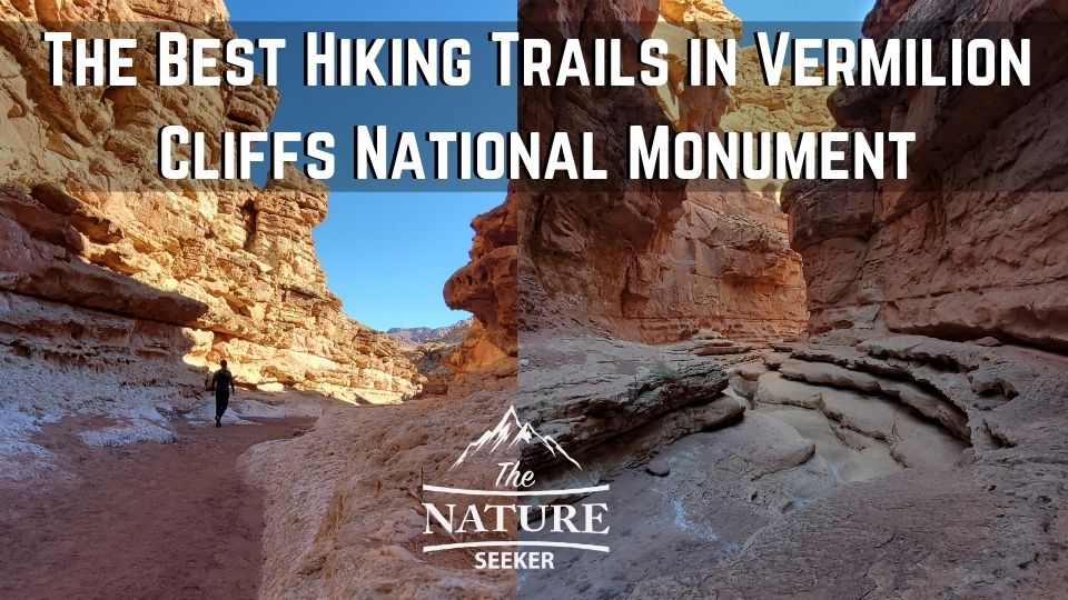
The 9 Best Vermilion Cliffs National Monument Hiking Trails
The Vermilion Cliffs National Monument region of Arizona offers many beautiful hiking trails to explore and in this post, I’d like to share 9 of them with you (the list will grow).
I visited this amazing area in early 2022 without much planning ahead of time and as such was shocked by how much you can do here. Aside from the many hiking trails available here, this place also features many tourist friendly things that don’t involve difficult trail walks or hikes, and towards the end of this post, I’ll also share the many other things you can do here, but let’s not waste anymore time and get to it:
Here are the 9 best Vermilion Cliffs National Monument hiking trails:
- The Wave hike (Coyote Buttes)
- Cathedral Wash Trail
- Spencer Trail
- White Pocket Trail
- Maze hike
- Sun Valley Mine Trail
- Wire Pass hike
- Paria Canyon hikes
- Honey Moon Trail
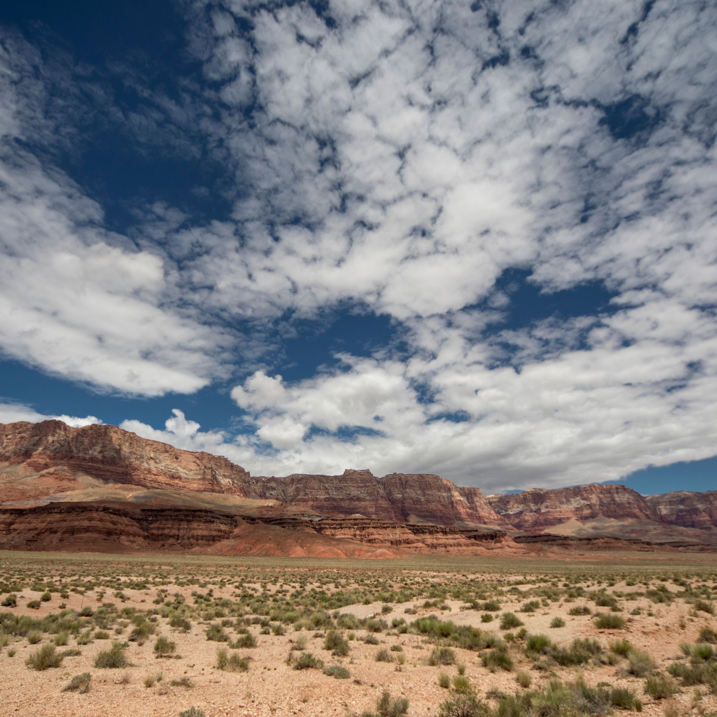
Keep in mind that outside of Vermilion Cliffs also lie plenty of amazing hiking opportunities and places to see. One such place in my experience is Wahweap Hoodoos and also the town of Kanab where there’s also lots to see (a great next stop).
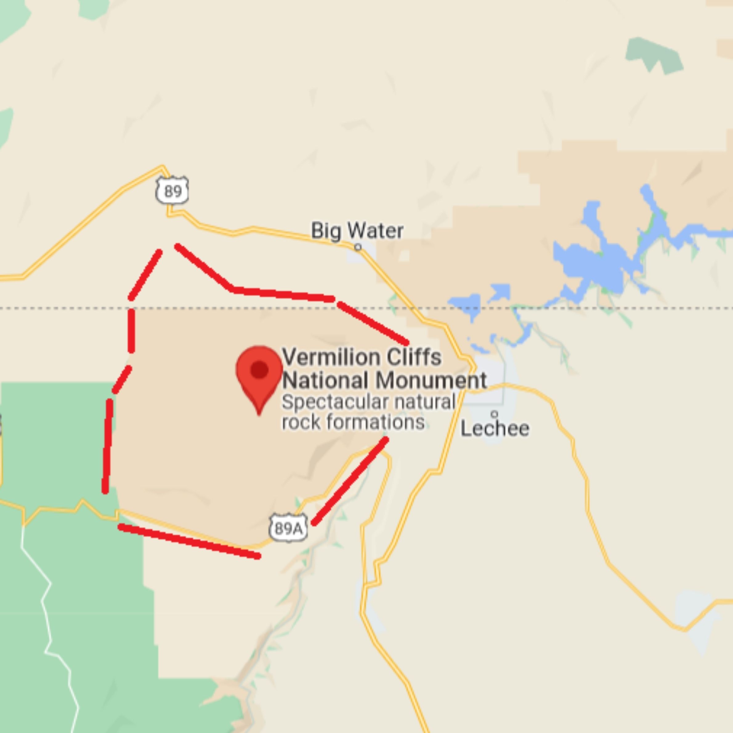
Here’s a Vermilion Cliffs National Monument map and common questions you see about it:
Can you visit Vermilion Cliffs without a permit?
Yes there are numerous spots and hiking areas where you don’t need a permit. However, access to certain areas require you pay a car fee to get in like Honey Moon Trail.
Can you see Vermilion Cliffs without hiking?
Yes there are several roads around and inside Vermilion Cliffs you can drive on without ever having to hike.
Can I drive through the Vermilion Cliffs?
Yes, there are 2 main roads going around Vermilion Cliffs (89 and 89A). There are also local and dirt roads going further into the area and to several popular hikes in the region.
How many days do you need in Vermilion Cliffs?
About 3 days in Vermilion Cliffs is enough to explore most of the hiking trails and check out the scenic roads, overlooks and other adventures there.
Now onto the best Vermilion Cliffs hikes:
We’ll begin with what is probably the most popular trail in all of Vermilion Cliffs:
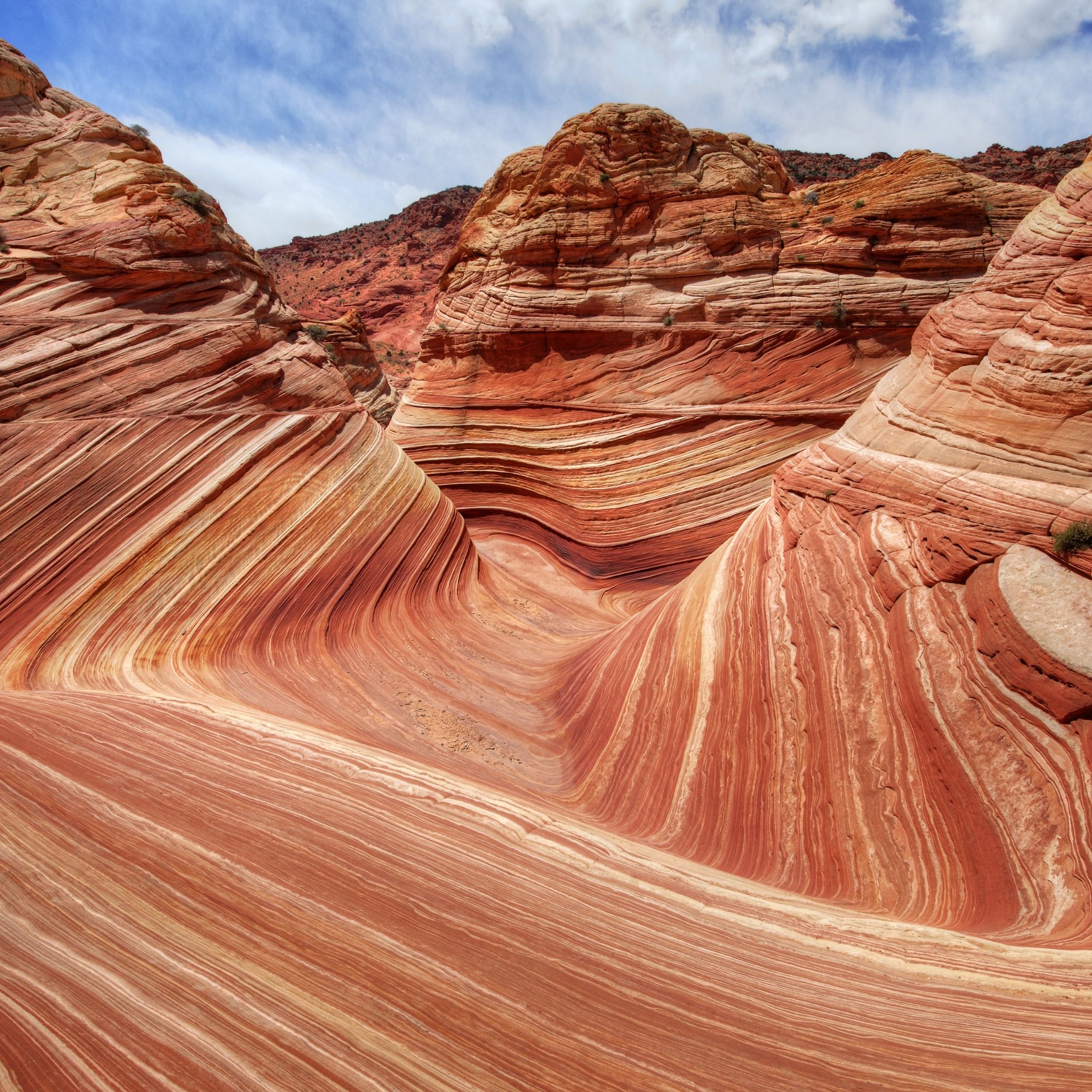
The Wave hike:
- Hiking distance: 7 miles
- Difficulty: Hard
- Permit required? Yes
- Where to start: Wire Pass trailhead
- Rating: 5 out of 5
To get to the Wave, you will need to enter into a permit lottery system and “hope” you can get access. I say hope because this is the most popular hike in Vermilion Cliffs and as such, it gets a lot of people registering to get that permit. If you do happen to get it, know that this hike requires path finding and as long as you use a compass and prepare accordingly, you’ll have a lot of fun on this hike (no real trail to follow).
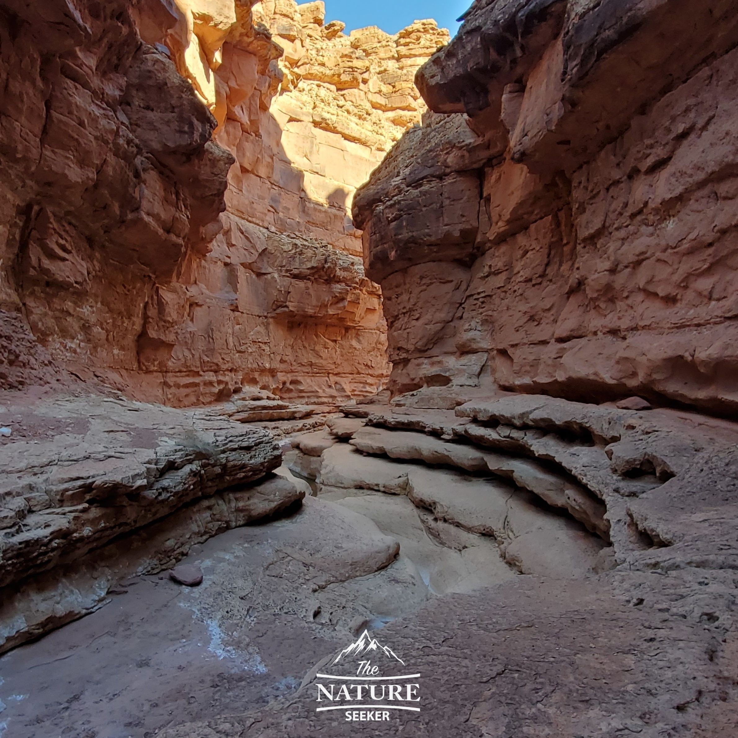
Cathedral Wash hike:
- Hiking distance: 3 miles
- Difficulty: Moderate
- Permit required? No (entrance car fee required).
- Where to start: Cathedral Wash trailhead
- Rating: 5 out of 5
If you enjoy challenging and very scenic hikes, absolutely do the Cathedral Wash trail. It is an incredibly beautiful, challenging and fun hike that is easily 5 stars. You will basically work your way down from the road into a canyon/wash type of terrain that takes you to the Colorado River, then work your way back to the road.
It is an incredibly fun hike that requires no permit, but read my article above on what to expect when you go here. I would not recommend taking young, inexperienced kids/adults or animals on this hike as some spots require climbing and jumping onto the next part of the hike.
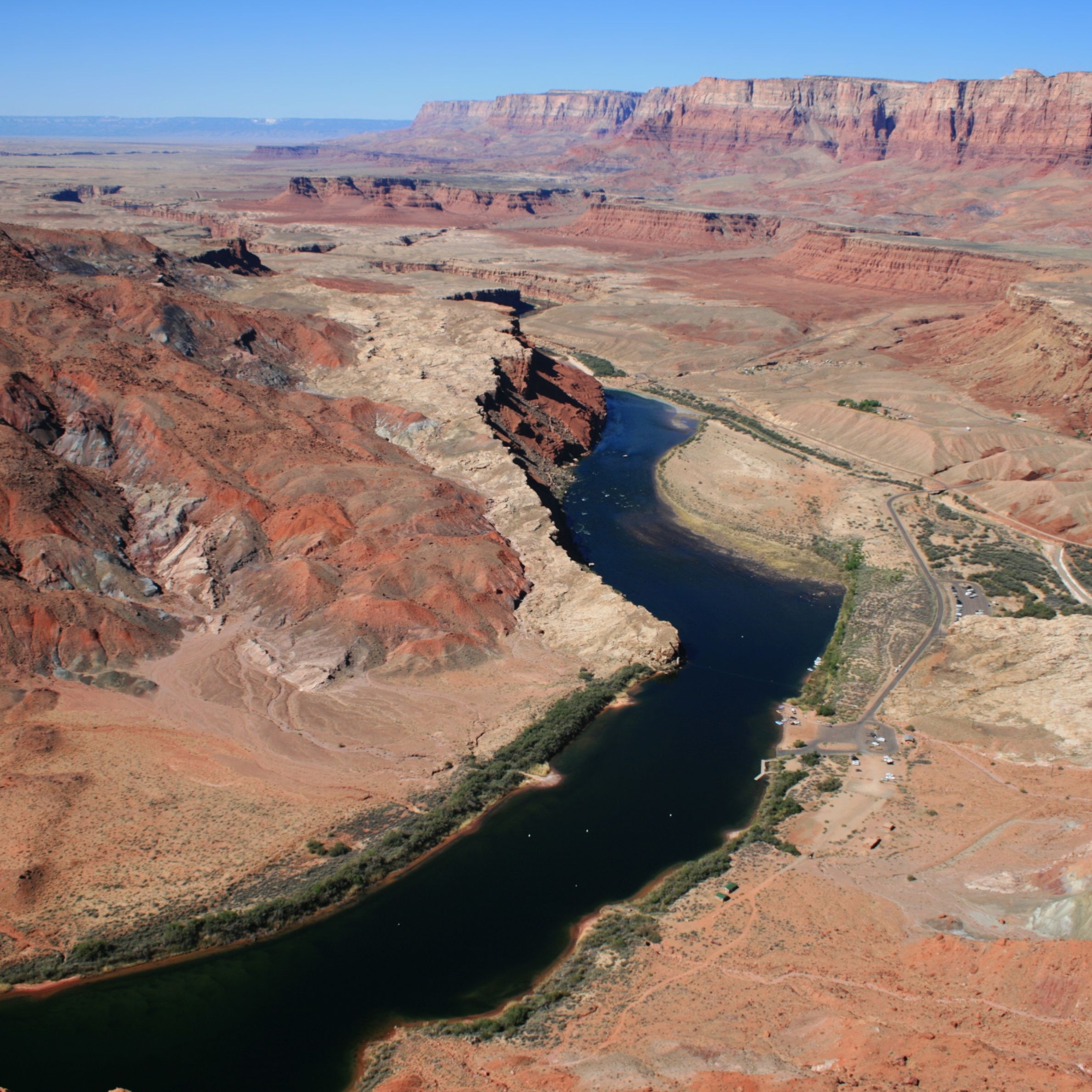
Spencer Trail:
- Hiking distance: 4 miles
- Difficulty: Hard
- Permit required? No (entrance car fee required though)
- Where to start: Spencer Trailhead
- Rating: 5 out of 5
The Spencer Trail in Lees Ferry is a very cool trail you can check out after Cathedral Wash (it’s off the same road) and basically gives you a beautiful hike to check out that overlooks the Colorado River, Marble Canyon and even Horseshoe Bend (from a great distance though).
Additionally, people can also do some boating and kayaking around this area as it’s considered the starting point entrance into the Grand Canyon (from the river). You may also notice that the terrain here looks very similar to what you see in the Grand Canyon (but lower in terms of elevation).
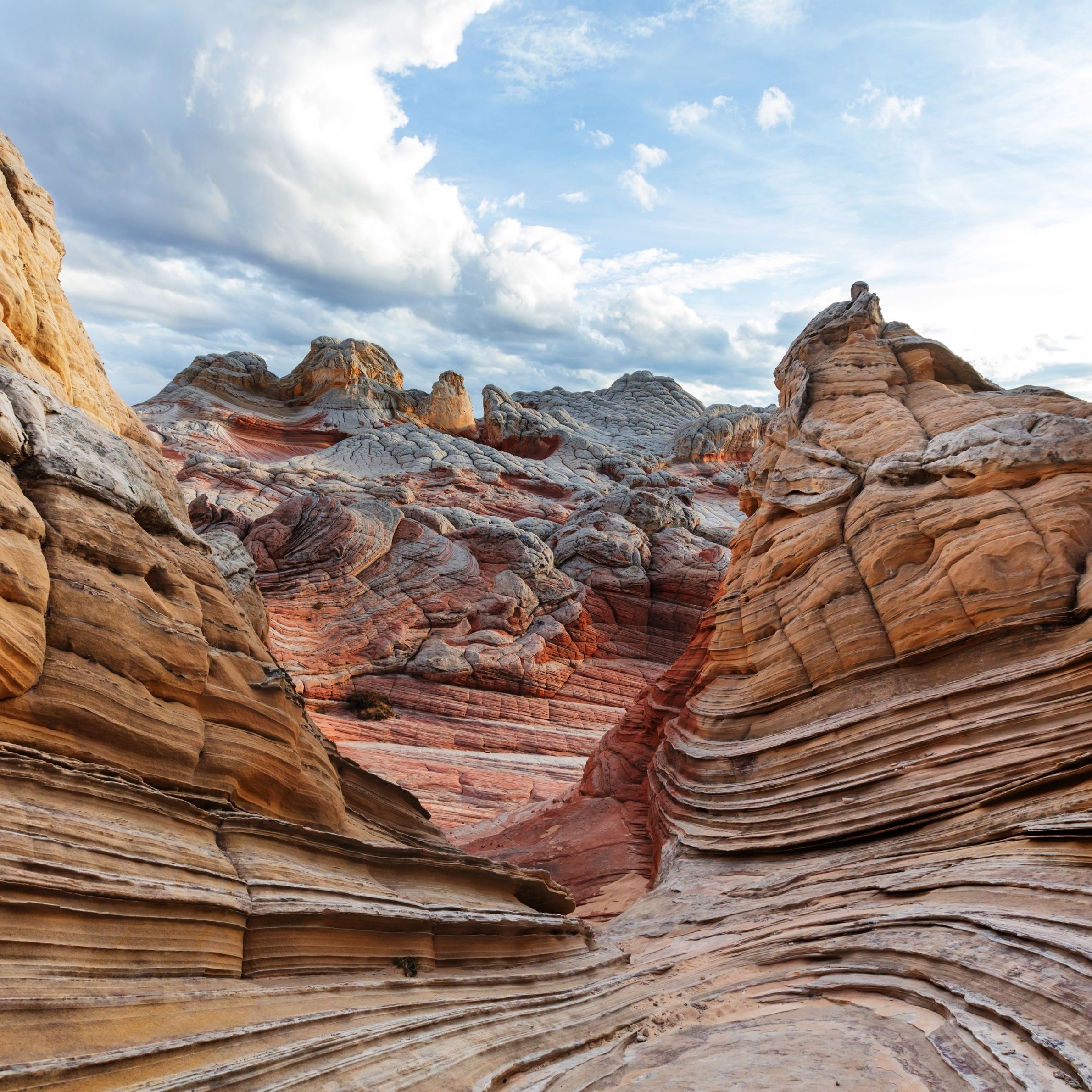
White Pocket hike:
- Hiking distance: 2 miles
- Difficulty: Moderate
- Permit required? No
- Where to go: White Pocket map
- Rating: 5 out of 5
The White Pocket hike is very scenic and also an excellent alternative to the Wave hike because it’s close by. While there is no permit needed to do the hike, you will have to drive off road to get to the trailhead. Do note that the GPS to get there is often unreliable and you will want to download a more updated map to get there (included above).
Fortunately, hiking to the actual White Pocket and exploring it is not that far from the parking area. Just as well, there are many who consider this specific hiking region to be the most beautiful in all of Vermilion Cliffs National Monument (for good reason).
Maze hike:
- Hiking distance: 1.5 miles
- Difficulty: Moderate
- Permit required? No
- Where to go: Maze hike location
- Rating: 4 out of 5
The Maze hike might be one of the easiest hiking trails in Vermilion Cliffs National Monument. But what makes it worthwhile is that the trailhead is right off the road (House Rock Rd) and in addition to that, it also gives you access to awesome petroglyths in the region. The hike is mostly in open terrain so do wear a hat and bring water (especially during warmer seasons). Contrary to the name “Maze”, the hike is not difficult in route finding and is pretty easy to do.
Sun Valley Mine Trail:
- Hiking distance: 2.5 miles
- Difficulty: Easy to moderate
- Permit required? No
- Where to go: Sun Valley Mine Trailhead
- Rating: 4.5 out of 5
This is another really cool hike whose trailhead is right off the road (in this case 89A) and here, you will walk on an old road that is also well marked to the mountains on the southern end of Vermilion Cliffs and also get a GREAT view of the valley when you do. This is an easy to navigate hike that is short, scenic and good for just about any hiker. And in case you’re wondering if there’s actual mines on this trail, the answer is yes. Most of them are closed off with gates, but it’s a really cool “Easter Egg” you can also explore.
Wire Pass hike:
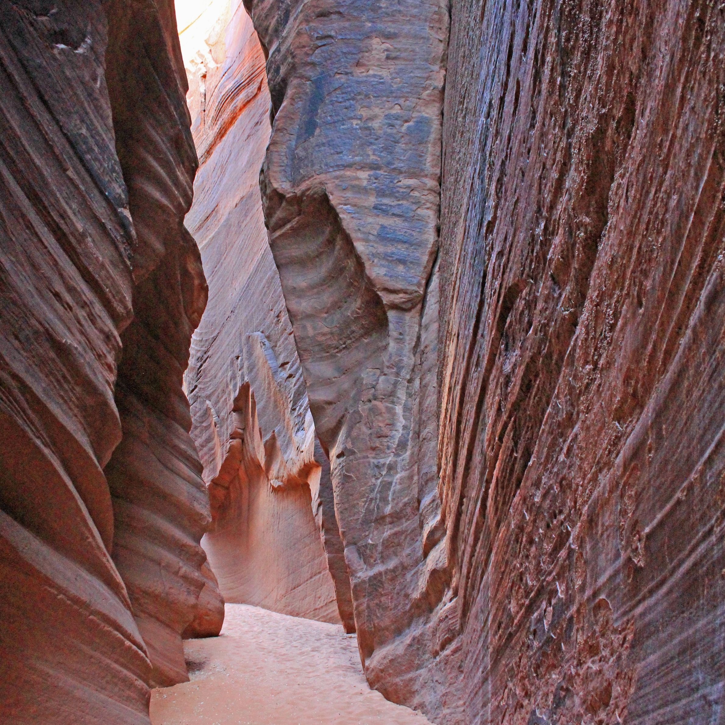
- Hiking distance: 3 miles
- Difficulty: Moderate
- Permit required? Yes
- Where to go: Wire Pass trailhead
- Rating: 5 out of 5
Wire Pass Trail is one of the several entrance points and connections within a very popular hike within the Vermilion Cliffs that is known as Buckskin Gulch. This particular hike is a much shorter part of it that can be done as a day hike if you are tight on time. I personally completed this trail several weeks ago (in November 2022) and I highly recommend it!
It’s actually in part connected with Grand Staircase Escalante in Utah and once you pass Wire Pass trail and head into Buckskin Gulch (which I would not do unless you are prepared as this can be a long and dangerous add on hike), you’ll be in Arizona and the Vermilion Cliffs area.
Paria Canyon:
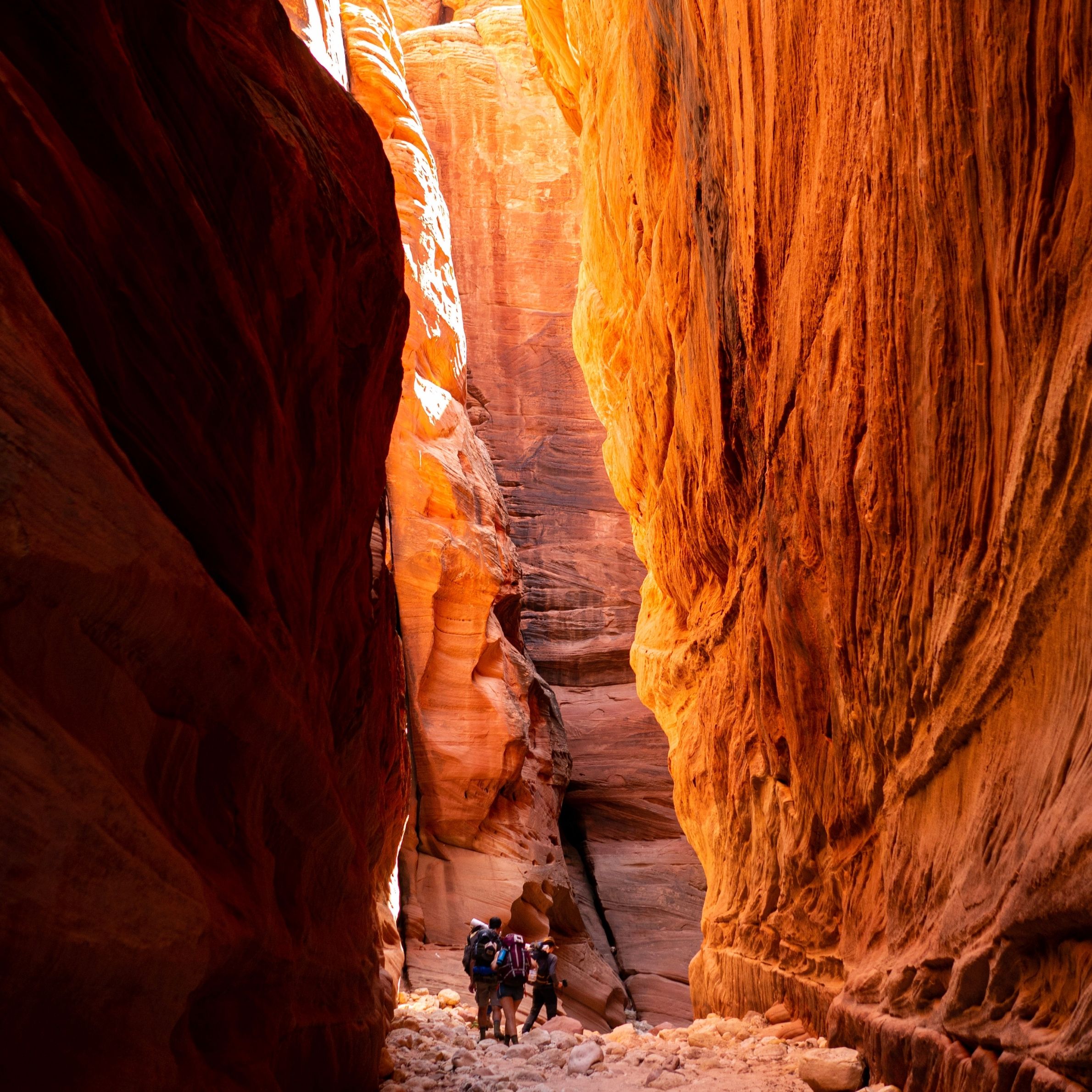
- Hiking distance: 20+ miles
- Difficulty: Hard
- Permit required? Yes
- Location: Wire Pass trailhead
- Rating: 5 out of 5
Paria Canyon happens of be one of the most popular points that intersects with Wire Pass and Buckskin Gulch. It also provides access to many different hikes, views and trails which is why the “total” hiking distance is over 20 miles. I would recommend you visit this site to get more info on Paria Canyon. You can also get info on permits, maps and more there. Some people choose to do a small portion of the trails here if they are doing day hikes, while others do the entire Buckskin Gulch, which passes through Paria Canyon (very advanced trail).
Honey Moon trail:
- Hiking distance: 15+ miles
- Difficulty: Moderate to hard
- Permit required? No, just an entrance fee for your car.
- Location: Honey Moon Trail
- Rating: 5 out of 5
If you enter the Vermilion Cliffs from the southern end, you will have the option to pay a small car fee to enter what is known as the Honey Moon Trail, which is a beautiful road that actually has 2 of the hiking trails on this list (Cathedral Wash and Lee’s Ferry).
However, aside from offering access to those 2 hikes, you can also do the very scenic drive on this road which is about 10 miles long, and that itself presents access to many beautiful landmarks, scenic walks and much more. You can do the drive along Honey Moon Trail or park your car and just walk along the road and up whatever hikes you see nearby. Either way, the scenery here is stunning and at many points when I was there, I had to stop and just take in all the beauty.
Related:
The above locations are all located around the Vermilion Cliffs and also offer a bunch of amazing hiking trails to explore. The closest city to the Vermilion Cliffs though would be Kanab or Page AZ depending on which side you enter it from but you can stay in either town and explore a bunch of the hikes above. Overall this is one of my favorite places to visit in Arizona and I strongly recommend checking it out!
Hi Vitaliy. Thanks for the info on Vermilion Cliffs. Looks like there are some beautiful canyons to explore. I have not explored this region and I am a casual hiker so which one of these would you recommend for a starter hike? Looks like you could get turned around pretty quick so I would want something to start with that has good trail markers and guidance. All the best. Dave
Hi Dave, for starter hikes there, possibly a portion of Cathedral Wash (first area), and White Pocket would be awesome ones to explore. I’ve labeled the easy hikes on the list too so you can filter it out that way.
Thanks for sharing this resource with the best hiking trails at Vermilion Cliffs. I am in the planning phase of a trip there, and this has been very helpful narrowing down the best things to do (since we know we won’t be able to see them all). I definitely want to do the spectacular-looking wave hike, but it is helpful to know that access depends on a lottery system and to have an alternate plan.
The Wave itself is amazing (I have yet to see it though), but the whole region is one giant gem of adventures and scenic hikes and these other ones are certainly worth checking out Aly. Hope you have an awesome trip there!
We are heading west after some rv exploring on the west coast. Arizona seems to have some amazing spots for hiking. I am older so not really up for the difficult hikes. As well, we probably will not have fixed dates for anything so permits would not be a good choice. However, it seems like there are several hikes that you recommend that are easy to moderate without permits. I am going to do some checking to see if there are dispersed camping areas near the Vermillion Cliffs National Park. Thanks for the info.
Yeah there’s numerous hikes for which permits won’t be needed here, but you may have to pass for a day pass (for your car), but after that, it’s just impromptu spots to explore all around. The scenic drives around this area are also highly recommended!