How to Get to Rainbow Bridge National Monument For Beginners
I’m going to show you how to get to Rainbow Bridge National Monument and there are actually 2 ways to do it, one is by boat and the other is through a very long hike. The boat option is typically the most popular and easiest but there are those who may want to try the hike, so this post will go over both options to help you figure it out.
Quick info on Rainbow Bridge Utah:
- Name: Rainbow Bridge National Monument.
- Location: Utah (in a very remote area close to Lake Powell).
- Hike difficulty: If by boat, the hike is only 1-2 miles (easy), while the harder hike option is 20+ miles (hard).
- Family friendly? The boat option would be better for families.
- Rating: 5 out of 5.
- Recommended? Yes! Rainbow Bridge National Monument is absolutely amazing but you just need to know which way is best for you to reach it and this article will help with that.
How to get to Rainbow Bridge National Monument using the boat option:
You first need to rent a boat and there’s 2 options:
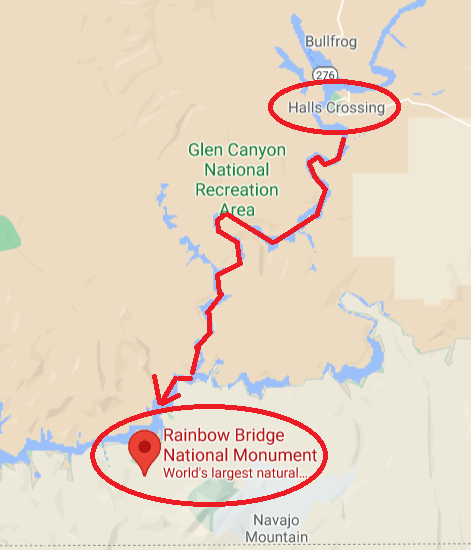
- Halls Crossing which is north of Rainbow Bridge (better to go here if you’re coming from the north).
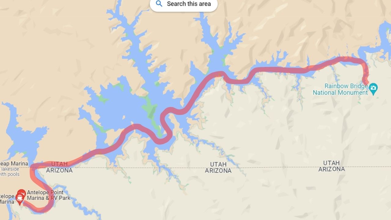
- Lake Powell which is south of Rainbow Bridge (better if you’re staying in the area which is Page Arizona and there’s also more options).
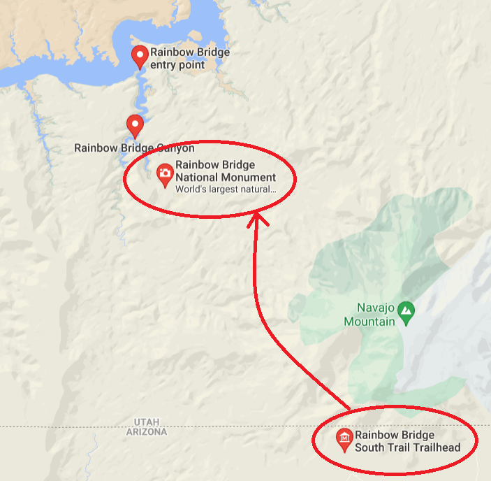
Directions to reach Rainbow Bridge from Halls Crossing:
- You’ll rent the boat (make sure you have a GPS).
- You’ll travel about 15 miles south to Rainbow Bridge trailhead and disembark there.
- You’ll hike to for 1-2 miles till you reach the Rainbow Bridge and then return back to the marina the same way.
Here are the Lake Powell Rainbow Bridge directions:
- There’s more options for rentals, but your direction will be north east (again, bring a map and GPS).
- The ride from most Lake Powell locations to Rainbow Bridge is about 45 minutes.
- You’ll disembark on the same trailhead area, hike 1-2 miles to Rainbow Bridge, then come back to Lake Powell.
Note: Be sure to get a map at whichever marina you rent a boat from to make sure you don’t get lost.
How to get to Rainbow Bridge National Monument via hiking (hard option):
- You need to start south of it (Rainbow Bridge South Trailhead) which is actually in Arizona.
- The hike is difficult and is over 15 miles long one way.
- You will need to get a permit before going (get it here).
- This hike is tough, long and I recommend doing it when the seasons are cooler.
Boat vs hiking, which is better to get to Rainbow Bridge Utah?
- The boat one is the easier and better for tourists or those tight on time (whether you rent a private one or go on a tour).
- And the second is hard and is better for more for serious hikers that plan to camp overnight in this area and understand how to hike/navigate.
You can see the official page of Rainbow Bridge here for more info, but I personally found it lacking in details, which is why I decided to write this post to help compliment reaching this beautiful spot in Utah.
Can you do the longer Rainbow Bridge hike in a day?
If you are in amazing shape and are used to marathon like trail runs, then yes, but otherwise, it’s unlikely and you shouldn’t do this unless you are in great physical condition. And again, if you decide to do this hike, remember this:
It gets very hot around these areas, and this is for most of the year. You’re looking at very hot temperatures from April all the way to October so if you don’t deal well with the heat but want to do this hike, winter time might be a better option for this hike. Either way, bring plenty of water for the occasion and supplies and of course it helps to be very experienced and in shape in general (I wouldn’t do this hike otherwise).
Questions about exploring the Rainbow Bridge National Monument:
Can you drive to Rainbow Bridge National Monument?
No, Rainbow Bridge National Monument is in a very remote place and to reach it, you have to either take a boat which will bring you to 1 mile from it, or hike it from the south which is a long overnight hike.
How far is the hike to Rainbow Bridge National Monument?
There are 2 hikes to Rainbow Bridge National Monument. One is from Glen Canyon which is 1 mile after you dock near the trailhead, and the other is an over 10 mile hike one way and requires a permit.
How much does it cost to go to Rainbow Bridge?
It doesn’t cost anything, but to reach Rainbow Bridge National Monument, you have to pay $15 for a car fee, and then a boat fee to get to the trailhead.
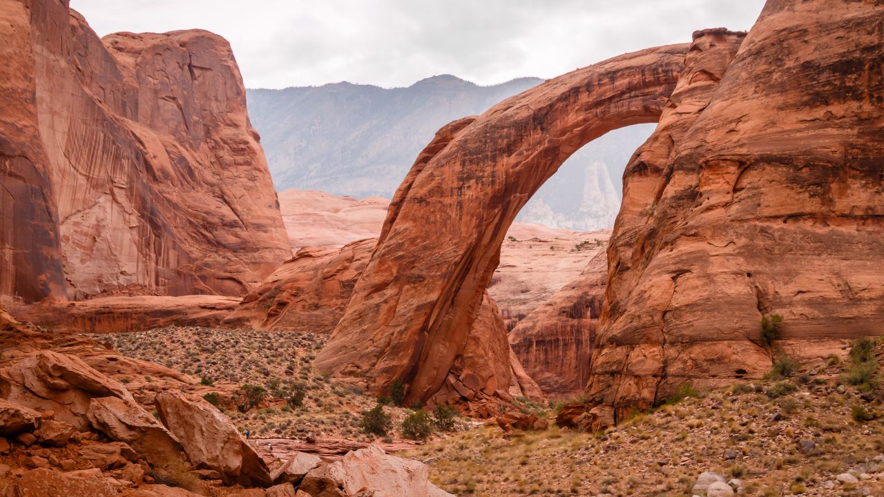
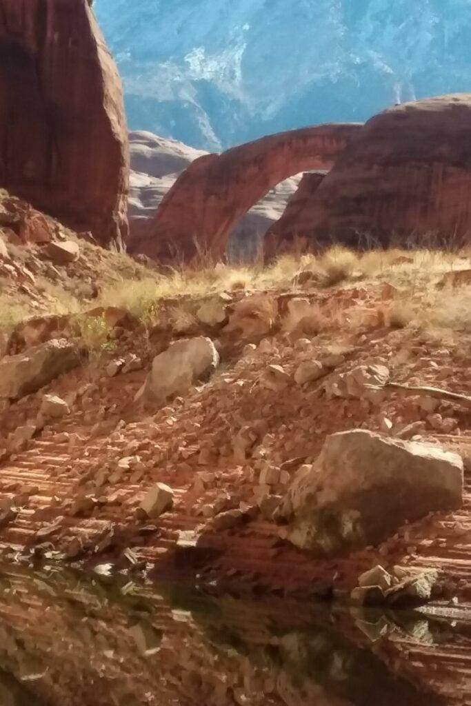
Can you walk under Rainbow Bridge?
I don’t know of any restrictions from being able to hike to and under the Rainbow Bridge National Monument.
More amazing sights to explore near the Rainbow Bridge area:
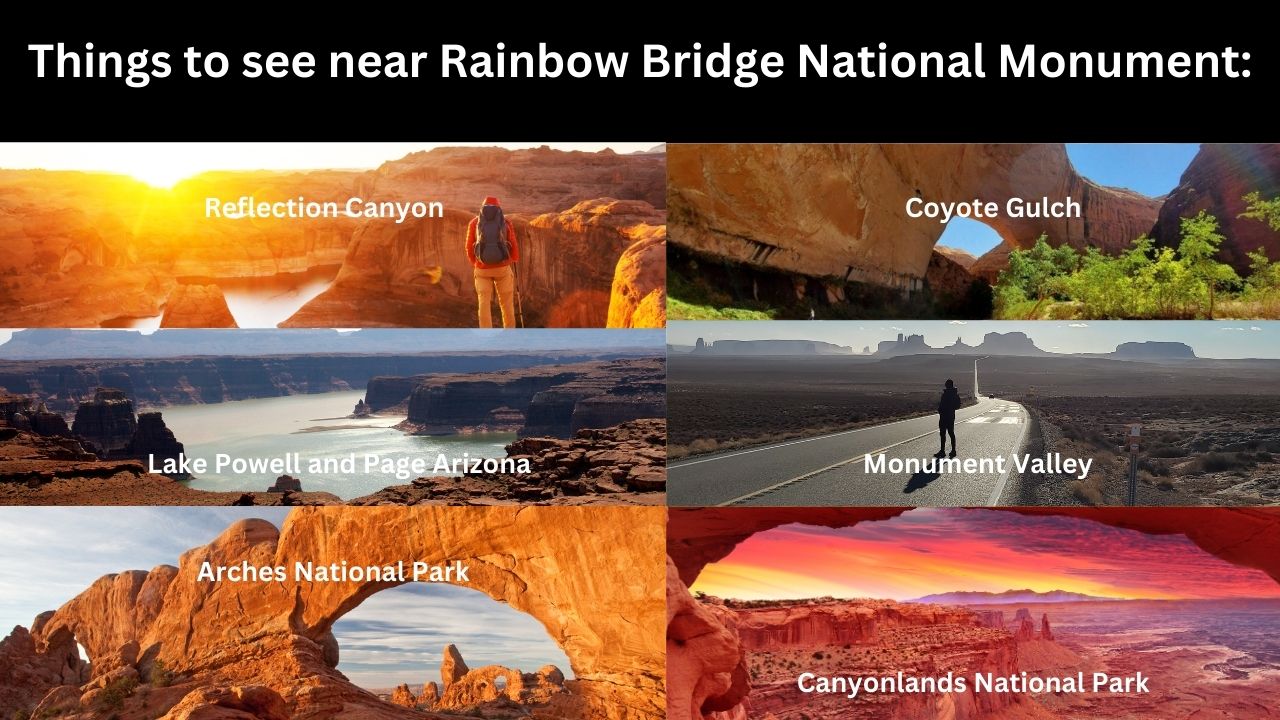
1) Reflection Canyon and Grand Staircase Escalante:
Reflection Canyon is actually on the other side of Lake Powell and Rainbow Bridge. To get there, you will need to first enter a place called Hole in the Rock Road in Grand Staircase Escalante, and then follow it to the end where the trail to this place will start. It’s long, difficult and easy to get lost on but if you’re confident about the drive and hike, you can totally do this while also exploring other amazing places there like Coyote Gulch which is a remote trail I list as one of the best hikes in Utah.
2) Exploring Lake Powell:
Just cruising the waters of Lake Powell is itself an experience because the area is huge, there’s plenty of kayaking spots, swimming areas and secret gorges and arches to check out like La Gorce Arch.
3) Several of the Mighty 5 National Parks (Capitol Reef, Canyonlands and Arches National Parks):
If you’re traveling to Rainbow Bridge from Halls Crossing (north of it), you can then finish in the area and head over to these parks after. Capitol Reef is amazing and has many beautiful, tourist friendly hikes to see including 2 giant natural bridges, Canyonlands National Park is basically another Grand Canyon area and Arches National Park has a wide array of huge natural bridges and arches too!
If you need help with planning how to do this, I have an article on how to plan a Mighty 5 road trip itinerary that can help you do this, and also see the other parks on that list which are Zion National Park (my top choice), Bryce Canyon National Park (small but awesome national park) and Canyonlands National Park which is close
4) Sedona and the Grand Canyon:
If you’re staying in Page Arizona and you’re looking for places to see south of that, then the Grand Canyon and Sedona are perfect places to add to a road trip itinerary (I’d add an extra 3-4 days to this). Although I have been to both and like Sedona more, but I did also create a Sedona vs Grand Canyon comparison article so you can see which place you like more.
5) Monument Valley:
To get to Monument Valley, you’ll have to drive north east for at least 2 or so hours but that area is also great for hikes and scenic driving, but just as well there many awesome things to do around Monument Valley to consider as well.
6) Bonus! Natural Bridge State Park:
This is not anywhere close to Rainbow Bridge, but there’s a similarly gigantic natural bridge in a place called Natural Bridge State Park in Virginia. It is way less remote and easy to hike to.
No! You can’t walk or stand under the bridge. The Diné (Navajo) tribe considers it a sacred place and walking under the bridge will get you in trouble with anyone from the tribe.