How to Get to Devils Punch Bowl Oregon
Awhile back I visited Devils Punch bowl Oregon and hiked down into it and in this article, will be showing you how to do that too. It’s an easy hike and frankly, there’s plenty of articles and videos showing you how to do this. But since you landed on this page, I’ll show you how to do it and more importantly:
- Give you some safety tips you should use when you go.
- And you’ll also find many other awesome spots on the Oregon Coast to visit near this area too!
Quick info on Devils Punch Bowl Oregon:
- Name: Devils Punch Bowl.
- Location: Otter Rock Oregon.
- Hike distance: Under 1 mile in and out.
- Difficulty: Easy.
- Rating: 5 out of 5.
- Recommended? Yes! You can see this attraction from the top and a hike that will get you down to Devils Punch Bowl, and other than some basic safety stuff to know, this is an easy place to visit and hike to.
How to Get There:
- Before you go here, only do this hike when low tide is present.
- Park in the official Devil’s Punchbowl parking lot or the one near the short trail down to it.
- Walk down to the beach via the trail.
- Turn left to the actual Punchbowl (watch your steps as it’s slippery there).
- Get into the Punchbowl and enjoy it before high tide comes back.
Most people who visit Devil’s Punchbowl usually only reach the top overlook area of it, but to hike down into it, you’ll need to follow a trail that’s nearby. And the funny thing is, there are no instructions or signs to it, which means you have to kind of guess which way to go. Luckily the trail is close and the hike to reach it is pretty obvious, but I’ll provide the simple and detailed instructions on how to get to Devils Punch Bowl anyway.
Follow this map:
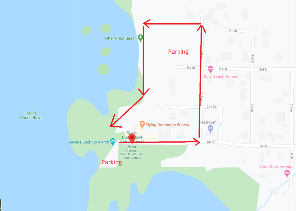
The hike from the parking lot to the actual Punchbowl is very short and shouldn’t take you more than 10-20 minutes to reach. There’s 2 parking areas you can use, with the northern one being closer to the actual trail. The western one is better to visit when you finish the hike inside Devils Punch Bowl and want to see it from the top (then you’ll just drive there). For the purposes of this post, I’m going to recommend you first start your hike down into Devils Punchbowl from the northern parking lot. That’s where you’ll find a trail sign to start the short hike down there.
Here is what the trail sign to Devil’s Punchbowl looks like:
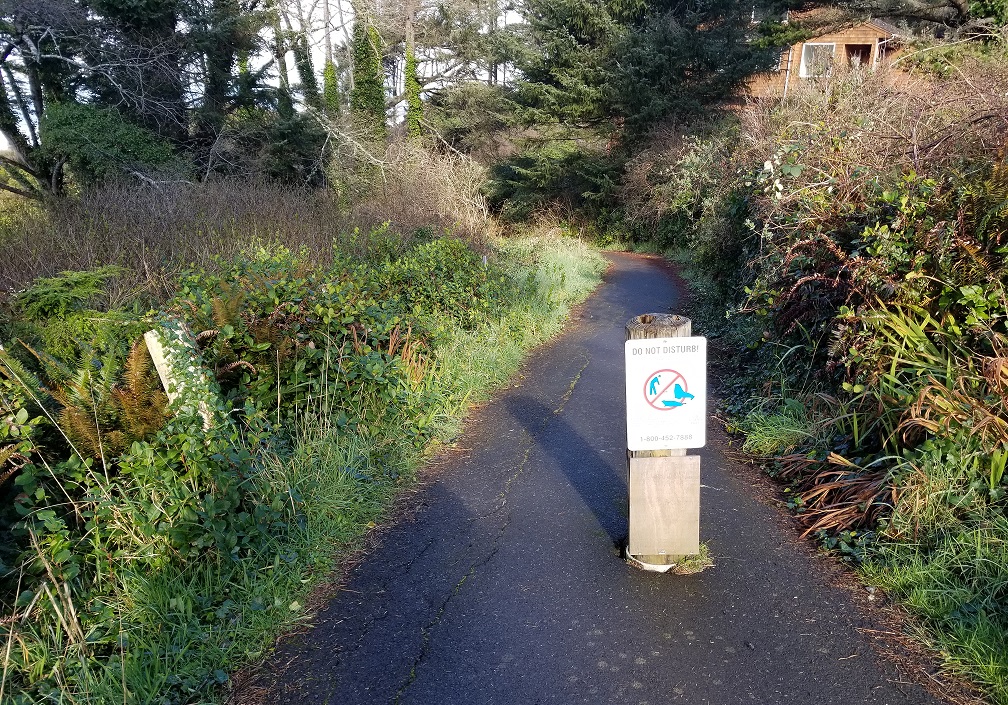
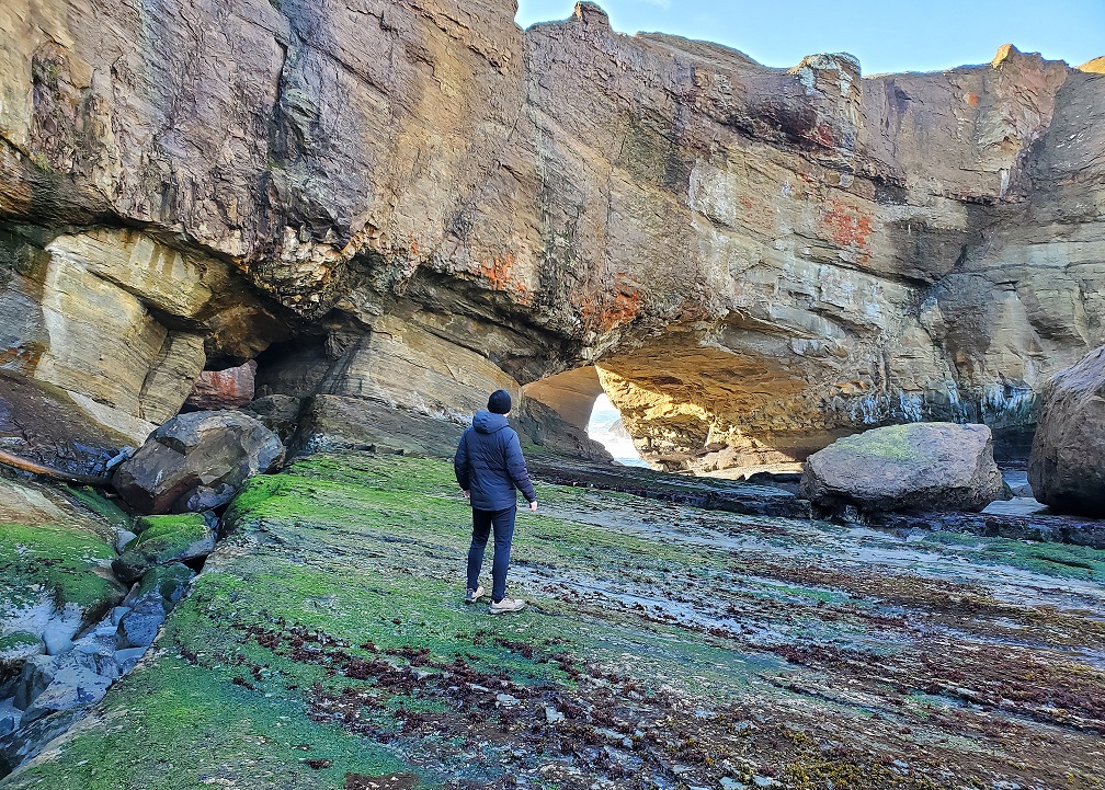
It’s a simple walk down to the beach from this point. After you get to the beach. Now the last time I was there, part of the trail road was broken due to erosion and there were some slippery areas (something to know), but either way you’ll just follow it down to the beach and then simply turn left (heading south).
From that point, you should be able to see Devils Punch Bowl in the distance (but not the sea caves too well just yet). You’ll just walk for another 10-15 minutes and as you get closer to it, then it’ll be easy to see:
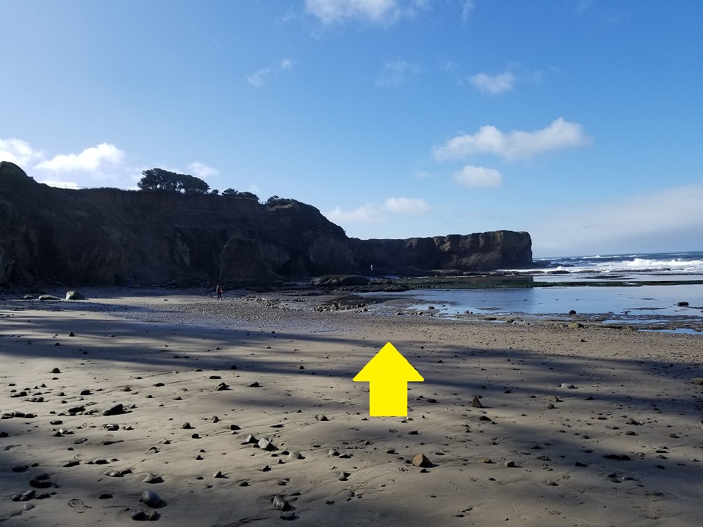
Another awesome thing I heard is that sometimes seals can be found on this beach (as the trail sign shows above), and it’s important not to disturb them, But anyway, follow that arrow above and you’ll reach Devil’s Punchbowl in no time.
Once you do get closer though, be careful because it’s very slippery:
You can wear hiking shoes like these that I used (Ozark trail shoes). Or you can wear water shoes. Either option will help make this part of the hike a little easier, but there will still be plenty of slippery areas especially as you get closer to Devils Punchbowl and then inside the cave areas (on the sea rocks).
Remember to time your Devils Punchbowl hike only during low tide:
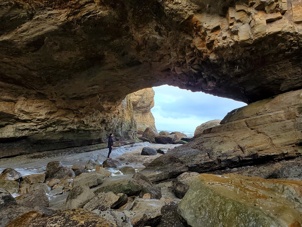
It’s seriously dangerous if you don’t and even deadly. You do NOT want to be here when it’s high tide or when it’s coming in so if you wish to stay here for a bit, plan your visit so you have a few hours of low tide time available. When you get inside, it’s truly beautiful inside:
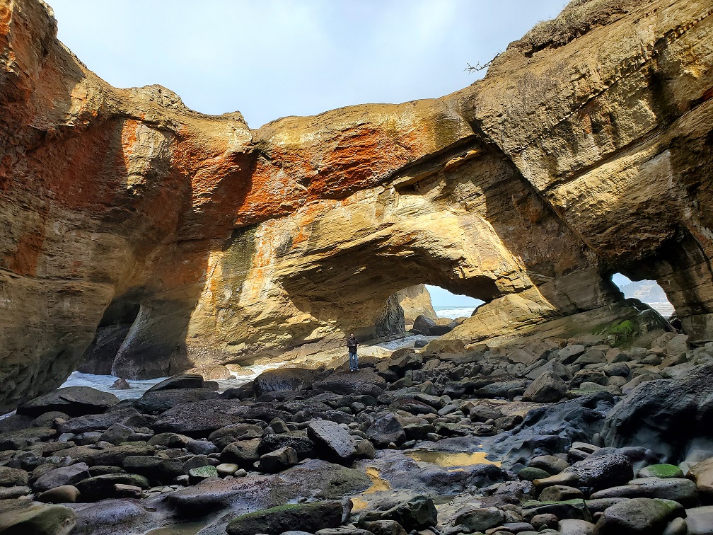
And aside from these natural bridges, there are some sea saves near this area you can also explore if there’s time (and Devils Punch Bowl in my opinion is one of the best places to see Oregon sea caves).
Anyway to the left of the above picture you’ll see a natural bridge with water. That’s where it comes in from when high tide hits, but during low tide, depending on what period you reach it at, you’ll be able to walk out that natural bridge and onto the beach. And of course, once you’re ready to go, just backtrack on the short trail to the parking lot.
What to do after:
Besides this attraction there isn’t much else other than a very nice view from the top of Devils Punch Bowl to check out with a few restaurants in the area. The top of Devils Punch Bowl is known as Devils Punchbowl Arch. While I do recommend seeing this place from above too and checking out the attractions, just know that there’s a bunch more places to see on the Oregon Coast but in terms of what the closest attractions are by this specific spot, I recommend 2:
- The Yaquina Bay Lighthouse (one of the best Lighthouses on the Oregon Coast).
- Otter Crest State Viewpoint.
Research Heceta Head Beach and Lighthouse. Cape Perpetua and Devils Churn. Sea Lions Cave is a tourist attraction that takes you down to a big cave that the Sea Lions use but if it’s sunny you’ll see them from above laying on the rocks. The prettiest drive along 101 is from Yachats south to Florence. The road was built along the edge of the mountain in areas. The best place to view sea lions is on the Newport Bayfront. The Oregon Coast Aquarium and the Hatfield Marine Science Center are well worth a visit. The column in Astoria is too. The Oregon Coast is by far better than Washington’s. You need to spend more time in the areas you drove through. Pacific City is worth checking out too.
Wow great suggestions Linda. I made a list of these new spots to check out next time I visit the Oregon Coast! Thank you very much!